Curated OER
The War of 1812
You won't find a better learning exercise than this! Here is a fabulous, comprehensive test on the War of 1812. Learners complete 50 questions of a wide variety; true or false, matching, fill-in-the-blank, multiple choice, and essays....
Curated OER
This Dynamic Earth: The Story of Plate Tectonics
Discuss Earth's tectonic plates at middle school level with an informative presentation. Packed with maps, satellite images, diagrams, and photographs, the slideshow connects with any curriculum focused on plate tectonics. It...
Curated OER
China is Unique
Sixth graders study the culture of China by comparing it to that of the United States. They write all questions and notes in a journal. The students access the internet to obtain the information and internet sites are suggested in the...
Curated OER
Map Directions and the United States
Third graders search TDC database for images of a compass rose, a miles marker, and a US map. They identify cardinal and intermediate directions to help identify their state and other states on a US map.
Curated OER
US Emergence of Power in the Pacific Northwest: General Howard and the Nez Perce Tribe War
Students discuss the role of the military in acquiring territory in the Pacific Northwest. Using a map, they locate the areas in which the Nez Perce were prominent and the routes used by the military to chase them. They discuss whether...
Curated OER
John Smith Map Lesson Plan
Fourth graders answer questions about John Smith, and also they figure out what was necessary are needed for surviival. Students are given a replica of Smith's 1612 map, they then answer questions using the map as their resource. ...
Curated OER
MAP MAGNETIC FIELD OF A ROOM
Students map the magnetic field of a room (classroom or room at home -- recommend kitchen) at two or more heights. They create a coordinate grid within the room and make a relatively accurate map of the room to super impose the...
Curated OER
INTERPRETING THE EFFECTS OF THE SPANISH AMERICAN WAR ON US CITIZENS.
Learners write an article about some aspect of American life during the war. -Examples include: Food, Travel, Weapons, Communication, Maps, Leadership. Each group of three will then be responsible for posting their article to the class...
Curated OER
Reading a Local and National Weather Map
Students practice reading a national and local weather map. Using this information, they work together to make predictions about the weather for the next few days. They discuss the use of symbols and maps as a class and discuss how...
Curated OER
When a Map Isn't A Map...
In this maps worksheet, students read about the Earth, sky, rivers and lakes, and more, and then answer short answer questions about it. Students complete 3 questions.
Curated OER
Language Arts: Creating Character Maps
Third graders select characters from books they have read to create character maps. After drawing the maps, they add the characteristics around a sketch of their chosen character. In groups, 3rd graders who have read the same book,...
Curated OER
Rockin' Map Summaries
Learners summarize a piece of text. After reviewing the correct way to read and summarize, students work in groups to summarize a piece of text assigned by the instructor. They write a summary paragraph by creating a story map and the...
Curated OER
US Presidential Election Process and the Campaign Trail
Students campaign for president. In this presidential election instructional activity, students discuss the process of electing presidents, write their own campaign songs, research a campaign train schedule, and create campaign maps.
Curated OER
Mapping the United States
In this map of the United States worksheet, students label mountains, surrounding countries, oceans, and more. Students complete 12 tasks.
Curated OER
Do You Need a Map?
Students explain ways marine navigation is important in modern society. In this map study lesson students use a retrieval tool to obtain real-time information on weather forecasts.
Curated OER
Maps that Teach
Students study maps to locate the states and capital on the US map. Students locate continents, major world physical features and historical monuments. Students locate the provinces and territories of Canada.
Curated OER
The People and Places Around Us
Students investigate the different kinds of habitats for humans, animals, and things. They illustrate the interior and exterior views of their homes. Finally they create a map key and a block map of their school neighborhood.
Curated OER
Edible Resource Maps
Third graders work in groups to create an edible resource map showing locations of at least five resources in the United States. Students research on the internet different regions and the resources that are found in those areas. They...
Curated OER
Mental Mapping Hangman
Students participate in mental mapping hangman activity. They choose the name of a country from a hat, draw that country on the board including at least one physical feature produced by nature or humans while not using any speech while...
Curated OER
Map It Out!
Students open their Alabama history book to the chapter on the Civil Rights Movement noticing how the chapter is broken into headings. They read a passage and as a class, create a story map focusing on the main ideas and details.
Freecloud Design
Stack the States™
Kids have fun learning US geography and state facts, including capitals, nicknames, major cities, and landmarks. They can choose between the game, or informational flashcards for each state.
Youth Leadership Initiative
Selecting a President: Primaries and Caucuses
What is a party caucus anyway? And what part do caucuses play in the primaries? Everything future voters need to know about the four stages in the presidential selection process is provided by this resource. The 2012 US...
Curated OER
Nature and Place Names in Arkansas
Middle schoolers examine the way that many place names in Arkansas came to be. By looking at Arkansas highway maps, they find names that come from the characteristics of each of the state's six geographical divisions. This interesting...
Curated OER
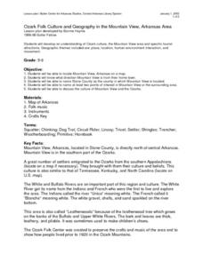
Ozark Folk Culture and Geography in the Mountain View, Arkansas Area
Upper grade through early high schoolers develop an understanding of Ozark culture, and the geography of the Ozark Plateau. They study place, location, human environmental impacts, and movement. This interesting plan incorporates muic,...
Other popular searches
- Us Map 13 Colonies
- Using a Map Key
- Using a Map Scale
- Ussr Blank Map
- Us Map
- Map Uses
- Ussr Map
- Us Imperialism Map Activity
- Using Map Scales
- Using Map Scale Distance
- Us Map Skills
- Usa Geography Map Skills


