Curated OER
New: Around the World
First graders identify and demonstrate how symbols and models are used to represent features of the environment. They use a map and a globe to label where the students in the book came from, point out the continent, and show which ocean...
Curated OER
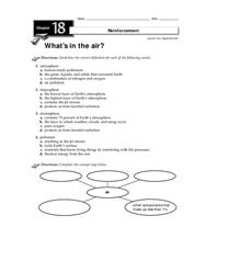
What's in the Air?
In this air instructional activity, students will choose the correct definition for atmosphere, troposphere, stratosphere, and pollutant. Then students will complete a concept map showing what components make up air. This instructional...
Curated OER
Read a Transportation Story
Eighth graders research the career of Arctic transportation. In this arctic transportation instructional activity, 8th graders read a book about Arctic truck travel and review the historical aspects of transporting goods in the Arctic....
Curated OER
Down on the Ocean Floor
Students build a map of the Atlantic Ocean floor and mark the different depths. In this ocean floor lesson students identify parts of the ocean floor that they created and discuss patterns that they see.
Curated OER
The Lewis and Clark Expedition
Students study westward expansion. In this US history lesson, students describe the adventures and hardships faced by the explorers known as Meriwether Lewis and William Clark. Students write a report to the President about the...
Curated OER
Opening Doors to Social Studies with Children's Literature: The Desert Alphabet Book
Students explore the geography of the United States. In this social studies lesson, students identify the major deserts on a map of the United States.
Curated OER
From Above
Students use maps and other geographic representations, tools, and technologies to acquire and report information from a spacial perspective.
Curated OER
Money Matters Curriculum
Students complete a concept map on how money matters in our society. They use the internet to discover an online exhibit about money. They also complete a concept map.
Curated OER
El Tiempo en Chile
Students analyze what information would one expect to find in a weather report. They list in Spanish weather conditions for today in their community. Students visit Chile and locate it on a map.
Curated OER
Space Exploration
Sixth graders identify and interpret the following: What is space?, Space Race, Living in space?, Man on the Moon, Astronaut training; students compare/contrast US and Russia space exploration. Students write a letter of application to...
Curated OER
New American Diplomacy
Young scholars explore the presidential era of Teddy Roosevelt. They read about American diplomacy in Asia, the Caribbean, and discuss the Panama Canal and the Roosevelt Corollary. As a class, students take notes and create a bubble...
Curated OER
Human Footprint
Students study facts about humans and how they are impacting the Earth. In this investigative lesson plan students help map peoples footprints over the Earth's surface and evaluate these factors.
Curated OER
Elections in America
Eleventh graders examine the election process in America. In this US Government instructional activity, 11th graders analyze the problems with the Electoral College. Students research a specific state and create a state flash...
Curated OER
Westward Ho: The Difficulties of Emigrants Moving West
Students research the journey west of 19th century emigrants. In this pioneer lesson, students read the letters and diaries of a fictitious family traveling on the Oregon Trail. They mark their route on a US map, create a chart showing...
Curated OER
Investigation 8 - Weather Forecasts
Fourth graders examine how to predict and evaluate weather forecasts. Discuss with students why weather predictions are important to us. Ask them what people do after they hear a forecast. They brainstorm reasons forecasts are important...
Curated OER
Family Life Among the Ashanti of West Africa
Learners examine the way of life of the Ashanti who live in West Africa. After locating the countries on a map, they are shown slides of artifacts to determine their uses. In groups, they compare and contrast the Ashanti's view of...
Curated OER
From the Farm to Your Table: Where Does Our Food Come From?
Students discover where the food they eat comes from. Using maps, they identify the agricultural areas of the United States and the products that are grown in each area. Using the internet, they research how food gets to America from...
Curated OER
A Digital Family Tree Trip Through Time
Students research their family history by creating a family tree and using online tools. In this family tree lesson, students use bubbl.us to research their biographical information and web the data. Students create timelines for their...
Curated OER
Reading the newspaper
Middle schoolers read articles related to local, state, national, and world events using word maps.
Curated OER
Early Arkansas Geography
Seventh graders locate and describe historical Arkansas while using a historical map.
Curated OER
Water in the Texas Coastal Basins
High schoolers, after researching a Texas coastal basin, map and graph the information they collect and then translate it into a short report to be presented to their classmates. They brainstorm unique ways to maintain Texas estuaries as...
Curated OER
Weather
Second graders study the basic components of weather. They construct a thermometer and anemometer to measure temperatures, precipitation, and wind speed. In addition, 2nd graders discover how to find these components on weather maps.
Curated OER
Why Does Delaware Have Such A StrangeShape?
Pupils examine the events and history surrounding the boundaries of Delaware. They participate in a class discussion and analyze a map, then create a floor map using masking tape. Students also participate in a play about the founding...
Curated OER
A Planting We Will Go
Learners explore how to transplant trees in their community. In this citizenship lesson, students construct a map of where to plant trees and then plant the trees.
Other popular searches
- Us Map 13 Colonies
- Using a Map Key
- Using a Map Scale
- Ussr Blank Map
- Us Map
- Map Uses
- Ussr Map
- Us Imperialism Map Activity
- Using Map Scales
- Using Map Scale Distance
- Us Map Skills
- Usa Geography Map Skills


