Thoughtful Education Press
Personal Narratives: Learning from Lessons Life Teaches Us
"First Appearance," Mark Twain's tale about overcoming stage fright, serves as a model of a personal narrative and gets young writers thinking about milestones in their own lives. After examining student models and considering the...
New York State Education Department
US History and Government Examination: June 2018
Ready to test your learners about anything and everything related to United States history and government? The resource uses multiple-choice and essay questions to assess knowledge.
Curated OER
Fourth Grade Social Studies
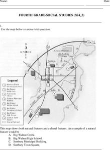
In this social studies worksheet, 4th graders answer multiple choice questions on state maps, city maps, road maps, political maps, and more. Students complete 25 multiple choice questions.
Curated OER
Map Making
In this map making worksheet, students draw a map of their home including a map key. In this drawing worksheet, students create one map.
Curated OER
Where I Live…
Second graders explore their community. In this social studies lesson plan, 2nd graders use Internet tools to locate their community on a map and then locate where they live.
Curated OER
California Geography
Fourth graders explore geography of four distinct regions of California: mountains, coast, central valley, and desert. They locate California on map, identify state's boundaries and borders, and explore agriculture, a major economic...
Curated OER
5th grade social studies geography
In this geography worksheet, 5th graders complete multiple choice questions about hemispheres, maps, cities, ecology, and more. Students complete 25 questions.
Curated OER
Directions, Directions
Third graders review cardinal directions, moving around the room so that they are standing in the part of the room that is nearest the north, south, east and west. They are asked what would you do if they are lost? Pupils work as a...
Curated OER
Crossing Time Zones
Students explore the concept of differing time zones. Students refer to maps to identify the time zones in particular regions. They role play phone calls from different time zones. This lesson is intended for students acquiring English.
Curated OER
Choose a Path
In this addition worksheet, students utilize data from a map to answer 6 fill in the blank questions where they provide the missing addends to addition problems.
Curated OER
Teaching With Documents: U.S. Constitution Workshop
What does it mean to be American? Explore the constitution and what it really means to be a citizen here. First, learners of all ages will investigate different primary source documents. Then, they establish each document's...
Curated OER
Putting It on the Map
Students consider the purpose of various types of maps and their different uses throughout history. They create their own maps and reflect on the map-making process.
Curated OER
Map Creation
Second graders identify a map, symbol, key, and compass rose. Students create and print a map for teacher evaluation using the computer. Students identify the symbols on their map and orally present them to the class.
Curated OER
United States Map- Rivers
Students learn about rivers. For this maps lesson, students describe rivers and what human activities take place in a river. Students use a map to locate the rivers in the United States.
Curated OER
3-D Topographic Maps
Students create a 3-D topographic map. In this map building lesson, students use cardboard to create a topographic map of the Catskills mountain region.
Curated OER
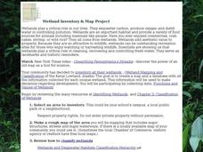
Wetland Inventory and Map Project
In this wetlands inventory and map project learning exercise, students do research on the wetlands and complete a map project about it. Students follow 6 sets of directions with Internet links.
Curated OER
Mapping China
Students identify cities in China on a map. For this map skills lesson, students locate the continent of Asia and the country of China. Students use a blank map to label China and bordering countries.
Curated OER
Lesson 4 Activity 1: Mapping the Third Dimension
Students work in pairs to construct a simple stereoscope.
Curated OER
Our World With MapsQ
Learners examine and compare different types of maps. In this map skill activity, students look at neighborhood and national maps on the overhead projector while making comparisons of the symbols and locations. They use a T-chart to...
Curated OER
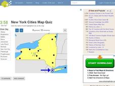
New York Cities Map Quiz
In this online interactive geography worksheet, students examine a map of New York and identify the 11 noted cities on the map using a pull down menu within 3 minutes.
Curated OER
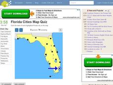
Florida Cities Map Quiz
In this online interactive geography worksheet, students examine a map of Florida and identify the 12 noted cities on the map using a pull down menu within 3 minutes.
Curated OER
Texas Cities Map Quiz
For this online interactive geography worksheet, students examine a map of Texas and identify the 15 noted cities on the map using a pull down menu within 3 minutes.
Curated OER
South America Map Quiz
In this online interactive geography quiz learning exercise, learners examine the map that includes all of South America's countries. Students identify the 13 countries in 2 minutes.
Curated OER
Middle East Map Quiz
In this online interactive geography quiz worksheet, students examine the map that includes 26 Middle Eastern countries. Students identify the names of the countries in 4 minutes.
Other popular searches
- Us Map 13 Colonies
- Using a Map Key
- Using a Map Scale
- Ussr Blank Map
- Us Map
- Map Uses
- Ussr Map
- Us Imperialism Map Activity
- Using Map Scales
- Using Map Scale Distance
- Us Map Skills
- Usa Geography Map Skills


