Curated OER
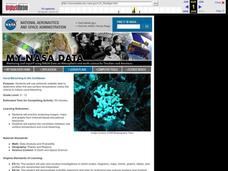
Coral Bleaching in the Caribbean
Students practice analyzing images, maps and graphs from Internet-based educational resources. They explore the correlation between sea surface temperature and coral bleaching. Students comprehend that coral reefs are collections of tiny...
Curated OER
Geography of South America
Student's identify geographic features of a South American map. They use the scale of the map to calculate distances between points. They identify examples of the five geographic themes on the map of South America.
Curated OER
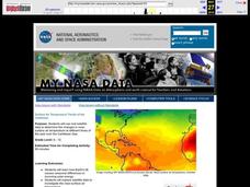
Surface Air Temperature Trends of the Caribbean
Students investigate the seasonal changes to sea surface and near-surface air temperatures near the equator. They use actual satellite data to track and graph the differences in air and sea temperatures during different seasons in the...
Curated OER
From Sea to Shining Sea
Students study the geography of the United States of America. Students write letters, create travel brochures, make maps, graph population numbers, read fiction and nonfiction selections, complete KWL charts, and watch films.
Curated OER
Exploring Marine Ecosystems in the Caribbean and Maine
Students compare the marine habitats of Maine and the Caribbean using temperature, tides, ocean currents, latitude and longitude. In this marine ecosystems lesson, students analyze maps to complete graphic organizers that evaluate the...
Curated OER
Coral Bleaching in the Caribbean
Students use authentic satellite data on the NASA website to determine when the sea surface temperature meets the criteria to induce coral bleaching.
Curated OER
Christopher Columbus
This is a nicely done presentation on the voyages of Christopher Columbus. Most young historians don't realize that Columbus made, not one, but four journeys from Spain across the Atlantic Ocean to the New World. This PowerPoint does a...
Curated OER
Seas, Gulfs and Bays
Students define gulf, bay, and sea. In this bodies of water mapping lesson, students locate seas, gulfs and bays and explain how they knew which body of water it was.
Curated OER
Follow That Ship!
Students in this exercise are introduced to the distinct ways of measuring distance (nautical miles) and speed (knots) at sea, as well as the concepts of latitude and longitude for establishing location.
Curated OER
What Do You Know About Oceans?
Students brainstorm and discuss what they know about oceans and seas, read poem My Ocean Speaks by Olga Cossi, discuss narrator's feelings about ocean, write reflective journal entries about their experience or inexperience with the...
Curated OER
The Science of Weather: Hurricanes
Students use this USA today activity to learn about hurricane season. In this hurricane lesson, students study the map of the earth and hurricane science. Students complete discuss questions. Students draw a map of the United States and...
Curated OER
Regions of the US: Gulf Stream, States and Their Capitals
Fifth graders identify one way of dividing the US into geographical regions and then consider alternate ways of doing the same. They locate each of the fifty states and their capitals on a map. They research the Gulf Stream region.
Curated OER
Monitor Marine Migrants
Students, in groups, track the seasonal journey of a species, such as a shorebird, sea turtle, or marine mammal, using various sources of migration data
Curated OER
Coral Snapshots
Using photographs and a coral reef identification key, junior marine biologists compare changes in coral cover for a No-Take Area and the surrounding unprotected area. The data that is collected is then analyzed for richness,...
Curated OER
Ocean Floor Properties and Near Shore Environments
Students explore and model the characteristics of the ocean floor and near shore environments through in-class demonstrations, laboratory activities, and internet research. They use classroom materials to research the characteristics of...
Curated OER
Parts of Speech
Nouns, verbs, pronouns...they're all covered here! This presentation gives a detailed look at each part of speech, but know that you cannott skip slides or start at any slide except for the first. Create a guide to keep your class...
Curated OER
The Commonwealth - Members and Structure
Learners research the member countries that make up the Commonwealth. They develop research skills using atlases. They define the word community. They complete an online geography quiz.
Curated OER
Verbs and Verb Phrases...With Pirates!
In this grammar worksheet, students underline the verbs and verb phrases in the 20 sentences. Students are also asked to circle the nouns and pronouns in each sentence.
Curated OER
Hurricanes Are They Coming to Your Neighborhood?
Students study weather systems, hurricanes and tropical storms. They predict landfall of hurricanes and tropical storms.
Curated OER
Winds of Change
Learners investigate extreme weather patterns. In this current events lesson, students visit selected websites to study hurricanes and their causes. Learners write reports on their findings.
Curated OER
Tracking the Storm
Young scholars discuss the different types of storms that can hit land. They locate specific coordinates on a plane grid. They discuss lonsgitude and latitude to plot the coordinates of a tropical storm. They practice finding...
E-learning for Kids
E Learning for Kids: Caribbean Sea: Antilles: How Does a Skeleton Work?
James identifies bones of the skeletal system and teaches us how they work with our muscular system for our body to function. Learn about the skeletal system, bone identification and muscle function. For every correct answer you can gain...
E-learning for Kids
E Learning for Kids: Science: Caribbean Sea: What Are Muscles?
This interactive module introduces young learners to the function of muscles by connecting them with pirate treasure. Learn about muscles and muscle identification, especially those muscles that help you really function. For each correct...
E-learning for Kids
E Learning for Kids: Science: Caribbean Sea: How Do Healthy Habits Affect Your Bones and Muscles?
We all need good habits to be healthy and strong. Take a trip to a turtle farm set in the Cayman Islands to learn about exercise, eating right, correct posture, and bone health. Win stars for every correct answer and earn a certificate...


