Curated OER
Coral Bleaching in the Caribbean
Students practice analyzing images, maps and graphs from Internet-based educational resources. They explore the correlation between sea surface temperature and coral bleaching. Students comprehend that coral reefs are collections of tiny...
Curated OER
Snow Cover by Latitude
Students create graphs showing the amount of snow coverage at various points of latitude and compare graphs.
Curated OER
Latitude Longitude
In this latitude and longitude worksheet, students place a dot on a graph that represents each latitude and longitude location given. The worksheet has 46 locations to graph.
Curated OER
Latitude Longitude
In this latitude and longitude worksheet, learners plot 39 latitude/longitude locations on a graph, connecting the dots as they go along.
Curated OER
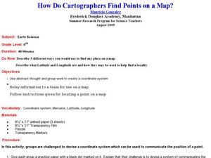
How Do Cartographers Find Points on a Map?
Ninth graders describe latitude and longitude and how they may be useful to find things on a map. In this cartography instructional activity students divide into groups and devise a coordinate system that can be used to communicate...
Curated OER
Latitude Longitude
In this latitude and longitude worksheet, students plot 34 latitude/longitude locations onto a graph, connecting the dots as they go along.
Curated OER
Basic Mapping Skills
Establish and study the parts of a map with your class and, then they will work in small groups to create their own detailed map, including a legend. There are specific instructions to follow on what needs to be included.
Curated OER
Snow Cover By Latitude
Middle schoolers create graphs comparing the amount of snow cover along selected latitudes using data sets from a NASA website. They create a spreadsheet and a bar graph on the computer, and analyze the data.
Curated OER
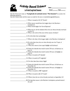
Latitude, Longitude, Seasons
In this latitude and longitude worksheet, students use their classroom notes on both longitude and latitude lines as well as seasons to complete 20 fill in the blank questions.
Curated OER
Latitude Longitude Skills
In this latitude and longitude worksheet, students determine the number of degrees between the equator and specific latitude points. Students to the same for the longitude points from the Prime Meridian. This worksheet has 3 problems to...
Curated OER
Give Me Some Latitude
In this latitude activity, students use an atlas or other reference to respond to 4 multiple choice questions about the equator and the poles.
Curated OER
What's Your Temperature?
Learners take a look at the local newspaper and focus on the weather section. They get into small groups, and each one looks at the same map, but of a different part of the country. They must prepare a presentation that shows how...
It's About Time
Where are the Volcanoes?
Middle school geologists map the volcanoes closest to themselves, learn about map distortion, and infer possible future volcano locations. A focus on latitude, longitude, and volcanoes beneath the ocean helps connect the lesson.
Curated OER
World Geography - Climate Notes
A challenging activity helps young geographers explore the temperatures around the world! They study how the Earth's land temperatures are affected by their proximity to an ocean, as well their latitude and their altitude. A very...
Science Matters
Ring of Fire
Over a period of 35 years, earthquakes and volcanoes combined only accounted for 1.5 percent of the deaths from natural disasters in the United States. The 15th lesson in a 20-part series connects the locations of earthquakes and...
Curated OER
Musical Plates-Earthquakes
In this plotting earthquake data worksheet, students use a large world map and given web sites showing the latitude and longitude for the epicenter of recent earthquakes around the world. Students plot 2 weeks of earthquake data...
Curated OER
Where in the World
Students explore the global grid system. In this globe lesson, students identify latitude and longitude lines and how these can tell the coordinates of any place. They use the Internet to find the exact coordinates for their town.
Curated OER
Degrees and Minutes
In this latitude and longitude worksheet, students place 9 cities on a map using the latitude and longitude of each. Once cities are placed in the correct location, students complete 2 short answer follow-up questions.
Curated OER
Where in the World Is ...?
Students move themselves around a "world" map on the classroom floor, using lines of latitude and longitude to locate specific spots. They determine the locations of 11 countries where Peace Corps Volunteers are serving and identify in...
Curated OER
Latitude and Longitude- Online Interactive
In this maps learning exercise, students learn about longitude and latitude by reading a two paragraph text and studying two maps. Students answer 9 fill in the blank questions. This is an online interactive learning exercise.
Curated OER
Topographic Map Unit Plan
Pupils examine topographic maps and discover how to decipher contour intervals, use contour lines and apply information to complete a topographic map lab. Working in groups, they identify the scale of the map, latitude and longitude,...
Curated OER
Introduction to Maps
Students investigate different types of maps and their purposes. In this mapping lesson students complete a worksheet, participate in a class discussion and do a hands on activity.
Curated OER
States with Attitude, Latitude and Longitude Dude
Sixth graders identify states whose boundaries are formed by lines of latitude and longitude or natural borders such as rivers. They trace a map of the U.S., and fill in borders, rivers and lines of latitude and longitude.
Curated OER
Tracking Satellites Using Latitude and Longitude
Students investigate how to track satellites using latitude and longitude. They investigate what man learns from all the satellites currently being studied today. Students analyze the four basic types of satellite orbits.
Other popular searches
- Latitude and Longitude Maps
- Maps, Longitude and Latitude
- Longitude & Latitude Maps
- Longitude Latitude Maps
- Maps, Longitude Latitude


