Curated OER
The Interconnectedness of Ancient Peoples Map Study
Seventh graders begin this lesson by viewing various maps of the Ancient World. As a class, they take notes on the changes of different areas in Europe and Asia as their teacher lectures to them. They answer questions about the...
Curated OER
East Meets West Quiz
In this East meets West quiz learning exercise, 8th graders answer 30 questions in 6 rounds of the quiz, about geography, inventions, religions, art, schools and language with questions written in Chinese and English, including maps,...
Curated OER
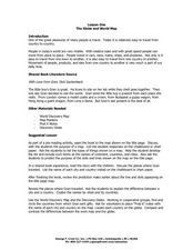
The Globe and World Map
Students explore how to use maps for travel. In this map skills instructional activity, students read the text, With Love from Gran and discuss the places the character traveled. Students list the names of each city and country on chart...
Curated OER
Chinese Cities Map Quiz
In this online interactive geography quiz activity, students respond to 10 identification questions about Chinese cities. Students have 3 minutes to complete the quiz.
Foreign Policy Research Institute
A Geography Lesson
Fewer and fewer people have a strong grasp of world geography, but this activity helps students understand geopolitics by creating their own original historical map. The activity requires selecting a country from the list provided,...
Curated OER
Chinese Classroom Internet Activity
Students use the internet to complete an online activity in Chinese. Using the weather section, they research the weather conditions in Hong Kong and other popular cities in China. They answer Chinese questions in Chinese about the...
Curated OER
Drifting Continents
In this plate tectonics instructional activity, students study the continents map and complete 8 short answer questions related to them. They predict what the Earth will look like millions from now.
Curated OER
Yam and Eggs
Learners gain knowledge about the different kinds of foods people eat around the world for breakfast. They look at a map and see if they can come up with reasonable answers as to why location may affect what people eat. Students also...
Curated OER
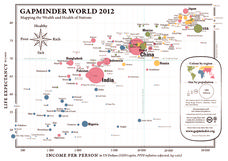
Gapminder World 2012
Here is a very interesting infographic that compares the average life expectancies, per capita incomes, and population sizes of every country in the world in 2012.
Curated OER
Giving Verbal Directions/ESOL
Students practice giving verbal directions accurately and employ correct prepositions and prepositional phrases and adverbs when giving those directions. They focus on using correct grammar, imperatives and infinitives when giving those...
Curated OER
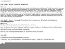
Central And South America And Their Ancient Civilizations
Fifth graders listen to lectures on the ancient civilizations of the Aztecs, Incas and Mayans. They construct a mask base and then decorate it in thirds with symbols meaningful to each of the three cultures being studied.
Curated OER
Architecture of China- A Web Based Search
Students use the internet in order to investigate the architecture of China. This is done in order to build an appreciation for the structures of buildings and how they communicate the culture.
Curated OER
Annotating Change in Satellite Images
Young scholars compare a series of satellite images taken 3-4 years apart to investigate the effects of human land use. They annotate the images using ImageJ software and use the annotated images to explain their findings.
Other
Hong Kong Zoological and Botanical Gardens
This is the home site for the Hong Kong Zoological and Botanical Gardens. This site houses a lot of information on everything from the plants, animals, history, and education associated with the Gardens. The site provides many pictures...
Central Intelligence Agency
Cia: World Factbook: Hong Kong
This resource from the CIA World Factbook provides a detailed fact sheet of Hong Kong. The content covers the country's geography, people, government, economy, communications, transportation, military, and transnational issues. It...
Nations Online Project
Nations Online: Hong Kong
Provides a country profile and comprehensive travel guide to Hong Kong, background details, and numerous links to key information on the nation's culture, history, geography, economy, environment, population, news, tourism, government,...
Encyclopedia of Earth
Encyclopedia of Earth: Hong Kong (China)
The Encyclopedia of Earth provides an overview of Hong Kong (China), including its geography, natural resources, history, government, economy, and much more. Maps and images are also included, along with sources used to create the entry.
Houghton Mifflin Harcourt
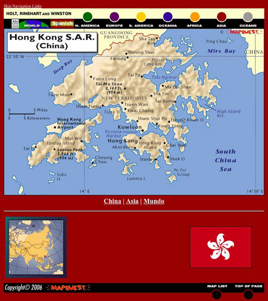
Holt, Rinehart and Winston: World Atlas: Hong Kong
See a map of Hong Kong and an image of Hong Kong's flag. The map includes names of cities, bodies of water, and elevations of Tai Mo Shan and Lantau Peak.
Curated OER
Science Kids: Science Images: Map of Hong Kong
A map featuring Hong Kong and its neighboring countries.
Other
Hong Kong Space Museum
Besides an introduction to exhibitions and events at the museum, the site provides a guide to stargazing, an astronomy FAQ, space news, virtual tours (see site map) and research resources (including Chinese-English star and constellation...
Curated OER
Educational Technology Clearinghouse: Maps Etc: Hong Kong, 1912
A map from 1912 of the Pearl River delta from Canton (Guangzhou) to Hong Kong and Macao on the China Sea. At this time, Hong Kong was a possession of Great Britain, and Macao was officially a Portuguese colony. This map shows the river...
Curated OER
Educational Technology Clearinghouse: Maps Etc: Hong Kong Island, 1912
A map from 1912 of the British colony on Hong Kong Island. Hong Kong was ceded to the British from the Qing Dynasty of China in 1842 under the Treaty of Nanking. The map shows the Hong Kong Harbor and Man of War anchorage around the city...
Latimer Clarke Corporation
Atlapedia Online: Political Map of China, Mongolia, Hong Kong, Macau
A great map of China and surrounding countries, with locations of major cities and bodies of water. Below map are links to general information on China and other countries.


