Curated OER
To Be Or Not To Be a State? That Is the Question
Eighth graders research Puerto Rico's culture, religion, language, government, etc. and identify differences and similarities with the United States. They participate in a debate about whether or not Puerto Rico should become a state.
Curated OER
Natural Resources and Transportation in the United States
Students study thematic maps (included with the lesson) to determine possible relationships. They develop three hypotheses about the relationship. Students choose one of their hypotheses to explain. The explanation is to include reasons...
Curated OER
Human Migration in the United States
Students investigate the factors involved in human migration in the United States. Students analyze maps of different regions in the United States to determine how a variety of factors influence human settlement and development.
Curated OER
Immigration to the United States
Third graders search TDC database for images of immigration from other countries, maps, and diaries. They identify why immigrants came to the United States and engage in a role-play simulating an experience the immigrants might have had.
Curated OER
Regions of the United States
Students explore the regions of the United States. In this geography lesson plan, students read the text When I Was Young in the Mountains and compare the setting of the story with their geographical setting. Students use a physical map...
Curated OER
The Asian American Experience in the United States: A Chronological History
Eleventh graders understand push-pull factor in Asian Amencan immigration. They identify patterns of Asian immigration to the United States and recognize their correlation to the concurrent socio-economic and political conditions of that...
Curated OER
Climate Patterns across the United States
High schoolers articulate differences between climate and weather using examples in a written statement. Using climate data from across the country, they describe climate patterns for various parts of the United States on a map. Students...
Curated OER
Geography of the United States
Students examine the population growth of the United States. In this Geography lesson, students construct a map of the fifty states. Students create a graph of the population of the USA.
Curated OER
Iowa State Map
In this Iowa state map instructional activity, students color and label the important cities and physical features. Students also study the background map that shows the location of Iowa in the United States.
Curated OER
States And Shapes
Students work together and investigate the shapes of 50 states. They identify the states that they find hardest to recognize. The group then list the states in order from most difficult to just difficult to recognize and create a...
Curated OER
Virginia State Map
In this geography of Virginia worksheet, students color the map and label major cities and physical features. Students also study a second map showing the location of the state of Virginia in the United States.
Curated OER
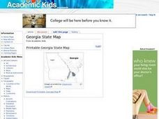
Georgia State Map
In this geography of Georgia worksheet, students color the map and label major cities and physical features. Students also study a second map showing the location of the state of Georgia in the United States.
Curated OER
Florida State Map
In this geography of Florida worksheet, students color the map and label major cities and physical features. Students also study a second map showing the location of the state of Florida in the United States.
Curated OER
Washington State Map
In this Washington map learning exercise, students color and label the major cities and important physical features on the map. Students also study a second map that shows the location of Washington in the United States.
Curated OER
California State Map
In this geography of California worksheet, students color the map and label major cities and physical features. Students also study a second map showing the location of the state of California in the United States.
Curated OER
Touring the Regions of the United States
Fifth graders explore the regions of the United States. In this geography skills lesson, 5th graders examine the landforms, climates, and economies of the regions of the United States. Students conduct Internet research in order to...
Curated OER
Touring the Regions of the United States
Fifth graders explore the regions of the United States. They use maps, research on the Internet and use measurements and estimations. Students create a presentation using spreadsheets and publishing software.
Curated OER
Showing "How Many" on a Map
Students investigate a map of 1873 that shows forest cover in the United States.They learn the concept of density and to illustrate landscapes in the United States.
Curated OER
The Role of Geography -- The United States and the Republic of Turkey
Preteens review the five themes of geography. In groups, they examine the United States and Turkey to discover how geography can impact the way people live. They create a foldable for each country, listing information for each of the...
Curated OER
Navigating Around the United States
Students calculate mileage and determine how long a trip take and what stops are necessary as they plan a vacation within the United States. They take money, food, lodging and gas into account for budgeting purposes.
Curated OER
Directions on a United States Map
Students generate directions for an imaginary trip. In this map instructional activity, students review the four main directions and how to use a map legend. Students locate destinations based on directions given by classmates.
Curated OER
Research a State in the United States
Students research one state of the United States of their choice. Using the internet, they gather as much information about the state as possible along with appropriate images. They present their findings to the class in the form of a...
Curated OER
Come Visit My State!
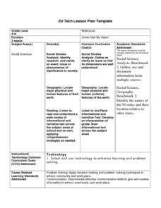
Fourth graders conduct research on a selected state in the United States. They complete a WebQuest and conduct research on a variety of websites. Students then organize and present a visual display about their state that includes a...
Curated OER
Our Fifty States
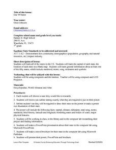
Seventh graders identify and locate all fifty states in the United States and their capitals. Individually, they research one state identifying when it became a state, its motto, song, flower and nicknames. To end the lesson, they are...
Other popular searches
- United States Maps
- United States Maps Regions
- Northeast United States Maps
- 50 United States Maps
- Create United States Maps
- Western United States Maps
- Custom United States Maps
- Outline Maps United States
- Blank United States Maps
- United States Landforms Maps
- United States Geography Maps
- United States Political Maps


