Curated OER
I Can Find that Where? - A Study of Landforms
First graders make landform maps of the United States. In this landform lessons, 1st graders participate in a discussion of local landforms and make a landform map of the United States. They follow the teacher's directions to add plains,...
Curated OER
Where Do I Come From?
Students research immigration from Europe to the United States. In this immigration instructional activity, students read the book, The Long Way to a New Land. Students use a world map to locate Sweden and other countries in Europe....
Curated OER
Chalkboard Challenge: Social Studies Online
If used as an independent review, this presentation could be a quick way for students to study U.S. History facts. Since it only presents a few simple facts, it would not be adequate for a comprehensive review, but a teacher could...
Curated OER
Empire State-Building
Learners explore how empires around the globe have impacted the world in which they have existed. They analyze whether or not the United States is an imperialist nation and create their own empires based on their understanding of empires...
Curated OER
A High-Interest Novel Helps Struggling Readers Confront Bullying in Schools
Bully, bullied, or bystander? Paul Langan's The Bully is the anchor text in a unit that examines bullying and violence. After a close reading of the text, readers imagine themselves as the characters and consider how they would react in...
Delegation of the European Union to the United States
The Geography of Europe
What is the European Union? Where is it? Why is it? To begin a study of the EU, class members examine the physical geography of Europe and the size and population density of 28-member countries in comparison to non-member countries like...
Curated OER
Literature Focus Unit: Civil War
Fourth graders complete a two-week unit on the U.S. Civil War and the Underground Railroad. They read the books "Follow the Drinking Gourd" and "Pink and Say," complete story maps, and dramatize a scene from "Follow the Drinking Gourd."...
PBS
An Attack on Syria- What Would You Do?
Has United States military intervention in the conflicts of other countries always been warranted? After reviewing a brief background on contemporary US conflicts and reading articles describing the civil war in Syria, your learners...
Curated OER
State Names: Frequency
Data grathers determine the frequency of specified data. They identify the frequency that specified letters occur in the names of all 50 states. They create stem-and-leaf plots, box-and-whisket plots and historgrams to illustrate the data.
Cornell University
Too Much of a Good Thing?
Continuing their study of beneficial insects, young entomologists discover where in the world some of these bugs are. By labeling, coloring, and using the scale on a map, pupils explore the territories and arrival of the Asian lady...
Education World
The African American Population in US History
How has the African American population changed over the years? Learners use charts, statistical data, and maps to see how populations in African American communities have changed since the 1860s. Activity modifications are included to...
Curated OER
Understanding "The Stans"
Students explore and locate "The Stans" in Central Asia to create, write and illustrate maps, graphs and charts to organize geographic information. They analyze the historical and physical characteristics of Central Asia via graphic...
North Penn School District
The Catcher in the Rye
Learning more about Holden Caulfield's worldview and state of mind is an integral part of understanding J.D. Salinger's The Catcher in the Rye. A thorough packet of materials pertaining to the unit allow learners to build prior knowledge...
Curated OER
Mock Election
Here is an excellent PowerPoint presenting loads of information about the US election process. Some of the topics included in the slide show: the reasons voting is important, how to choose a candidate, how the federal, state, and local...
Curated OER
The 50 States
Fifth graders use maps and music to learn the 50 states. In this US Geography lesson, 5th graders map out a region of the United States and practice singing the song, The 50 States that Rhyme.
Curated OER
United States Map- Land Elevation
Pupils explore a physical map. In this map skills lesson, students discuss examples of elevation and investigate the symbols used to identify elevation on a map. Pupils use the map to identify various land elevations.
Curated OER
Sharing The Land
Students investigate different geographical terms and concepts. This is done with practicing with maps of the United States to find major coasts, lakes, and rivers. They also put together a floor map of the United States. Students create...
Curated OER
United States Prepositions
In this prepositions worksheet, students use the clues to help them locate the positions of the state according to the prepositions given in each sentence.
Curated OER
Boundaries and People
Students map watersheds to find their boundaries. In this watershed activity students map and then give their "watershed address." Students show the trail from stream, larger stream to oceans. Students describe the boundaries of the...
Curated OER
Comparing Themes Across Texts
Read various texts to compare the themes across each text. Learners write a journal entry describing the most beautiful scenery they've seen and use a map of the United States to locate the Sequoia National Park and Muir Woods. They then...
Curated OER
Teaching With Documents: U.S. Constitution Workshop
What does it mean to be American? Explore the constitution and what it really means to be a citizen here. First, learners of all ages will investigate different primary source documents. Then, they establish each document's...
Curated OER
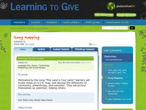
Song Mapping
Learners explore locations on the United States map. In this map skills activity, students recite the song This Land Is Your Land and locate various places listed in the song on the map.
Curated OER
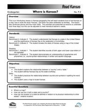
Where is Kansas?
Students explore U.S. Geography by analyzing a map. In this state vs. country lesson, students utilize a U.S. map and locate the state of Kansas before researching the history and customs of the state. Students collaborate as a class to...
Curated OER
Where is the Trail? The Journey of Lewis and Clark
Students explore the trail followed by Lewis and Clark on their journey across the United States. In this United States History lesson, students complete several activities to establish the Lewis and Clark Expedition, including a class...
Other popular searches
- United States Maps
- United States Maps Regions
- Northeast United States Maps
- 50 United States Maps
- Create United States Maps
- Western United States Maps
- Custom United States Maps
- Outline Maps United States
- Blank United States Maps
- United States Landforms Maps
- United States Geography Maps
- United States Political Maps


