Curated OER
Settlement Patterns of the United States
Students examine the conditions that affected the way people settled in the United States. Using maps, they examine the topography and climate of different locations and determine the factors that do and do not allow settlement to occur....
Curated OER
A Look at the Population Density of the United States
Learners acquire census information and create maps of the population density of the United States on different scales. They role play the roles of workers of a retail company and they use the population data to market to their customers.
Curated OER
From Claws to Jaws: Atlantic Regions of the United States
Students explore New England, Mid-Atlantic, and southeastern regions of the United States. In this social studies thematic unit, students research a state and make a regional quilt. Students wrte a book report and read two novels...
Curated OER
United States Map - Lesson 4: States
Students use a United States Map to locate their state and use map symbols to determine the boundaries of a state. In this states lesson plan, students learn the definition of a state and identify their own on a map.
Curated OER
United States Map- State Capitals
Students explore the state capitals. In this geography lesson, students use a political map to identify the state capitals and place post-it notes on various capitals.
Curated OER
United States Map - Lesson 7: Four Main Directions
Students locate the North and South Poles, and learn the definitions of the four directions by using a United States Map and a globe. In this directions lesson plan, students define north, south, east, and west on a map and a globe.
Curated OER
United States All the Way
Students create patriotic books about the United States and some of its special symbols.
Ashbrook Center at Ashland University
The Constitutional Convention
Imagine sitting down with representatives of your school to write a new student handbook. What arguments would ensue? How would compromises be made to finish the project? Scholars research the Constitutional Convention using a directory...
Statistics Education Web
The United States of Obesity
Mississippi has both the highest obesity and poverty rate in the US. Does the rest of the data show a correlation between the poverty and obesity rate in a state? Learners tackle this question as they practice their skills of regression....
Curated OER
Four Famous Faces
Each one of our quarters is embellished with a famous face or image representing the state it came from. This lesson uses South Dakota's state quarter to get kids thinking about monetary value, what the president of the United States...
Curated OER
United States Map - Lesson 11
Students explore lakes of the United States. For this geography lesson, students identify noteworthy lakes on a map of the United States.
Curated OER
U.S. Political Map
In this political map learning exercise, learners use the map of the United States and the 7 cities to measure the straight-line distance between the cities. Students add the total number of miles traveled and write their answers in the...
Curated OER
Tibet and the U.S.
Learners examine the relationship between Tibet and the United States. They explore the political relationship between the two countries. Students identify geographical features and political boundaries of the Tibetan and Chinese regions.
Artisan Global
QuakeFeed Earthquake Map, Alerts and News
Amateur seismologists explore Earth's earthquakes in real time using a variety of map styles and parameter selections.
Curated OER
Spy the Flycatcher
Explore the symbols and special features of Oklahoma. By focusing on Oklahoma's state bird, the flycatcher, learners identify similes, write metaphors, and answer questions about this famous state symbol.
New York State Education Department
US History and Government Examination: January 2012
What led to the United States Civil War? Interested historians consider a variety of political, social, and economic factors using primary sources and an essay prompt in an authentic high-stakes test. Primary sources include political...
Curated OER
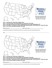
Mystery State #12
What's better than learning about US geography? Having fun while your doing it! After reviewing each of the five given clues, learners attempt to name the mystery state. A great way to reinforce geography skills and deductive reasoning...
Curated OER
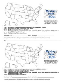
Mystery State # 24
Prepare those brains for a rousing day of learning with a fun geography activity. Your pupils use five different clues to determine the name of mystery state number 24. Where do all those potatoes come from? Idaho!
Curated OER
Map Study
For this geography worksheet, students study the United States. Students respond to 6 multiple choice questions about the map.
ESRI
Juneteenth: An American History through Maps
An interactive website traces the history of Juneteenth celebrations from their origin in Galveston, Texas, on June 19th to the present day. Using interactive maps, learners can find information about the African-American...
Curated OER
USA Postal Abbreviations Map
For this United States political map worksheet, students examine the postal abbreviations of each of the states.
Curated OER
United States 1860
For this United States historical map worksheet, students examine the state and territorial boundaries as well as the large cities of the nation in 1860.
Curated OER
Capitals, Oceans, And Border States
Students investigate geography by completing games with classmates. In this United States of America lesson, students examine a map of North America and identify the borders of Mexico and Canada as well as the Pacific and Atlantic....
Curated OER
States and Capitals
This map skills PowerPoint features an interactive states and capitals game. The object of the game is to identify the capital cities of each of the 50 states. The excellent presentation includes United States maps, game directions, and...
Other popular searches
- United States Maps
- United States Maps Regions
- Northeast United States Maps
- 50 United States Maps
- Create United States Maps
- Western United States Maps
- Custom United States Maps
- Outline Maps United States
- Blank United States Maps
- United States Landforms Maps
- United States Geography Maps
- United States Political Maps


