Curated OER
People Change the Landscape
Learners examine ways in which humans have brought change to the natural environment. In this ecology and literacy activity, students listen to the book Island Boy by Barbara Cooney. Learners observe and define map-reading vocabulary as...
Curated OER
U.S. Geography for Children: State Capitals
In this United States map skills activity, students locate and label specified states and their capitals, and create icons and a map key to show something for each state that is famous. Students answer 5 questions.
Curated OER
World War I
High schoolers justify how alliances lead to war. They compare the conflicts of war that arose because of imperialist interest. Students explain the cause of World War I. They compare and contrast European maps before and after World...
Curated OER
State Information
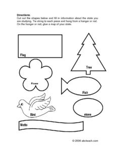
In these research worksheets, students will discover facts about one of the fifty United States. They are asked to research seven facts about their state including the state bird, state motto, and state flower. Students then create a...
Curated OER
Will There Be a White Christmas This Year?
Students examine historical weather data, and create map and color key that illustrates the likelihood of a white Christmas in different locations across the United States.
Student Handouts
Geography of Dr. Martin Luther King, Jr.
Young geographers follow Dr. Martin Luther King's journey during the civil rights movement by identifying major events on a map of the eastern United States, such as his birth in Atlanta, Georgia and his famous "I Have a Dream" speech in...
University of Florida
Sailing to St. Augustine
Using a Florida map from 1597, young explorers consider the physical characteristics they would need in a site for a new colony and the resources they would need to survive. After selecting a site, class members research to discover the...
Curated OER
Ancient Greece Map Worksheet
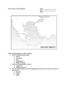
Since the beginning of time, geography has shaped the development of human civilization, and ancient Greece is no exception. This learning exercise supports young historians with exploring this relationship as they first identify key...
Smithsonian Institution
Borders with the World: Mexican-American War and U.S. Southern Borderlands
The Mexican-American War created social borders—not just physical ones. Scholars learn about the effects of the Mexican-American War on the people living in the borderlands using text excerpts, maps, and partnered activities. Academics...
Wells Fargo
Wells Fargo History Museum: Curriculum Guide
Learn about the California Gold Rush from an institution that has been in place since the early days of the American West: Wells Fargo History Museum. From domain-specific vocabulary review to group research projects, an expansive packet...
Alabama Department of Archives and History
From Alabama Farmer to Civil War Soldier
As part of a study of the Civil War, class members conduct a WebQuest to create a timeline of battles fought by the 10th Alabama Infantry Regimen. They then use Google Earth to pinpoint these battles of the Civil War on a map of Alabama.
National Endowment for the Humanities
Factory vs. Plantation in the North and South
North is to factory as South is to plantation—the perfect analogy for the economy that set up the Civil War! The first lesson plan in a series of five helps teach beginners why the economy creates a driving force for conflict. Analysis...
Curated OER
Sunny Symbols
After listening to a series of stories about signs and symbols associated with the United States, pupils discuss the importance of the sun in Native American legends and as a representation of New Mexico. As part of this exploration,...
American Battle Monuments Commission
The Great War: U.S. Division Under Allied Command
The victory of Allied forces in World War I is due in large part to the continued collaboration and support of the Allied divisions themselves. Learn more about the ways Australia, Britain, France, and the United States worked together...
Curated OER
The Kansas-Nebraska Act of 1854: Popular Sovereignty and the Political Polarization over Slavery
Why did Stephen Douglas support the Kansas-Nebraska Act of 1854? Why did Abraham Lincoln oppose it? Young historians examine how the Kansas-Nebraska Act of 1854 affected the political balance between free and slave states and explore how...
EngageNY
Grade 9 ELA Module 4, Unit 1, Lesson 15
The Haitian Revolution takes center stage as class members analyze a passage from Sugar Changed the World and consider how the authors select, present, and organize events to show how the tensions between the concerns for freedom and...
Carolina K-12
Colonialism and American Foundations Sample Test Questions
What was the main cause of European colonization in America? How did Thomas Paine's Common Sense play a role in the establishment of the United States? What was the trans-Atlantic slave trade? These are just a few of the many questions...
Curated OER
N is for Natural State
For any pupils who live in the state of Arkansas, this would be a fabulous educational experience to help them get to know their state better. Through the use of activities in literature, art, mathematics, science, social studies, and...
Curated OER
World War I - The War Ends
Your class is in for a treat with this outstanding PowerPoint on World War I. The presentation is loaded with facts, maps, important personalities, and discussion questions on the war. Additionally, there is a wonderful video called,...
Curated OER
The Natural State
Following an examination of the Arkansas state quarter, your class will discuss the state's nickname: "The Natural State." They will focus on its abundance of natural resources. Printables for the activities are included.
Baylor College
Mapping the Spread of HIV/AIDS
Where is HIV/AIDS most prevalent and what are the current trends regarding HIV? Have groups work together to map the world's HIV/AIDS rates, then create a class map with all the data. Lesson includes cross-disciplinary concepts including...
Anti-Defamation League
Impact of the U.S. Expansion on Indigenous People and Stereotypes About Native American People
The 2004 U.S. bicentennial sparks a discussion about its meaning and importance to United States history. Readings, maps, tables, and reflective writing prompt small groups to explore the westward expansion, Lewis and Clark, and how...
Curated OER
United States Map
Young scholars compare the United States on a globe and on a map. For this map lesson, students relate the sizes of the continents and locate the United States. Young scholars identify the location of the continental US as well as Alaska...
Curated OER
Let's Travel!
Students review the rules and expectations, they earn points each day by making the correct behavioral choices. They read maps and do Internet reserach, students become aware of United States and or world geography. Students check...
Other popular searches
- United States Maps
- United States Maps Regions
- Northeast United States Maps
- 50 United States Maps
- Create United States Maps
- Western United States Maps
- Custom United States Maps
- Outline Maps United States
- Blank United States Maps
- United States Landforms Maps
- United States Geography Maps
- United States Political Maps


