Curated OER
Exploration and Encounters
Fourth graders research explorers of the New World. In this American history lesson, 4th graders conduct internet & textbook research about various New World explorers. Students compare and contrast the sources used for...
Curated OER
Dos mapas de Florida, el Caribe y parte de Sur America
What can maps tell us about the past? Find out with a Spanish lesson that incorporates geography. After examining maps individually, comparing two old maps of Spanish Florida and writing notes in the provided Venn diagram, pupils pair up...
Syracuse University
Erie Canal
While canals are not the way to travel today, in the first half of the nineteenth century, they were sometimes the best way to move goods and people. Scholars examine primary sources, including maps and pictures, to investigate the role...
Teach Engineering
What's Wrong with the Coordinates at the North Pole?
Here is an activity that merges technology with life skills as individuals use Google Earth to explore the differences between coordinate systems and map projections. The self-guided instructional activity is the fourth segment in a...
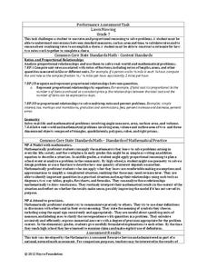
Noyce Foundation
Lawn Mowing
This is how long we mow the lawn together. The assessment requires the class to work with combining ratios and proportional reasoning. Pupils determine the unit rate of mowers and calculate the time required to mow a lawn if they work...
Port Jefferson School District
Hurricane Katrina
Young scientists track Hurricane Katrina across the Atlantic Ocean as they learn about these destructive forces of nature. Provided with a table of data tracking the location and conditions of Katrina over a one week span, students...
Advocates for Human Rights
A Global Perspective on Immigration
To gain a global perspective on immigration, groups investigate and create a map of the migration patterns in Africa, Asia, Europe, Latin America, and the Middle East. Class members then examine the background, immigration history, and...
US Mint
Desert Dwellers
What can a quarter possibly teach young learners about desert ecosystems? More than you might think. After displaying and discussing the included picture of the Arizona state quarter, the class participates in a series of...
Curated OER
EU and Turkey
Should Turkey be admitted to the European Union? Before debating this question, class members research the background and stated purpose of the EU, read articles of Turkey's bid to become a member of the EU, and the concerns other...
Curated OER
US City Quality of Life Analysis and Comparison
Students analyze US census data and criteria to compare and measure the quality of life in the country's fifty largest cities. After accessing the 2005 quality of life world report online, students conduct their study to compare three...
The Alamo
The Alamo
Remember the Alamo! Scholars investigate the Battle of San Jacinto during the Texas Revolution. Using models, maps, quotes, biographies, and the Oath of Allegiance, the Alamo comes to life as the stories of those who fought and died in...
Curated OER
E-mailing the Chamber of Commerce
Encourage effective internet research and e-mail correspondence as scholars investigate a US capital city they've never visited to find pertinent and relevant information. They begin by picking a city, then visit that city's chamber of...
Australian Government
The Great Artesian Basin
Covering 23% of the continent and holding 64,900 cubic kilometers of water, the Great Artesian Basin is the primary source of water for much of inland Australia. Using detailed student worksheets, experiments, and case studies,...
PBS
Working with Coordinate Planes: Activities and Supplemental Materials
Seven activities make up a collection of supplemental materials to reinforce graphing on a coordinate plane. Worksheet objectives include plotting coordinates within single and four quadrants, measuring straight and...
Curated OER
Searching the Net
Students create a Native American Nation flip book. In this Native American lesson, students choose one of four Native American Nations: The Iroquois, Hopi, Seminoles, Sioux. They research them on the Internet using teacher given...
Curated OER
Deserts
Students do various activities to explain where the United States' desert region lies in relationship to the state in which they live, become familiar with plants and animals in the Sonoran desert, and make a story map of Roadrunner...
Curated OER
Ancient Greece: Athens as a City State
Sixth graders find Greece on the map and recognize how the geography of Greece was important in its development. In this ancient Greece lesson, 6th graders research Greece and compare to the civilization of ancient Egypt. Students answer...
Curated OER
Regions and Habitats
Fourth graders identify the different habitats found in the seven regions of the United States. In this ecology lesson, 4th graders write an essay about how humans affect the ecosystem and vice versa. They discuss how changes on one...
Curated OER
The Rise of the City States in Greece
Sixth graders examine Ancient Greece and its development of democracy. In this Greek History activity, 6th graders explore the rise of city-states in Greece and its overall effect on the development of democracy. The class continues with...
Curated OER
U.S. Post Office Mural Walking Tour
Students discover a sense of community by examining Post Office murals located in cities and small towns throughout the United States. They explore the significance of the murals by contacting and communicating with local Postmasters....
Curated OER
Freedmen's Bureau
Students examine the African American experience after they received their freedom after the Civil War. They complete a Mind Map, read and analyze a poem, and write a paragraph using key vocabulary words. They analyze the impact of the...
Curated OER
Landmarks of the Underground Railroad
Students explore Civil Rights by reading several books in class. In this Underground Railroad lesson, students discuss The Story of Henry Box Brown and identify the location and functionality of the Underground Railroad. Students answer...
Curated OER
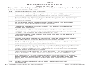
The Civil War Comes to Kansas: The Battle of Mine Creek
Seventh graders explore the impact of Price's Raid and the Battle of Mine Creek. In this American Civil War lesson, 7th graders examine a list of events based on the war in Kansas and then put them in chronological order. Students also...
Curated OER
American Culture in a Musical Setting
Students discover the significance of similarities and contrasts of three separate cultures of the United States through music. They take out maps and trace the expedition of the Spanish along the coasts of Mexico and North and South...
Other popular searches
- United States Maps
- United States Maps Regions
- Northeast United States Maps
- 50 United States Maps
- Create United States Maps
- Western United States Maps
- Custom United States Maps
- Outline Maps United States
- Blank United States Maps
- United States Landforms Maps
- United States Geography Maps
- United States Political Maps


