Curated OER
Finding Your Spot in The World; Geography, Maps, Multi-Culturalism
Students use a variety of maps to locate their home, their school and the origin of their ancestors.
Curated OER
Orienteering - Lesson 1 - Maps & Map Scales
Lesson 1 of 10 lessons in this orienteering unit is about maps and map scales. After all, orienteering is all about maps, compasses, and finding ones' way around. It is imperative to be able to read maps and understand the relevance of...
Curated OER
United States Map - Lesson 9
Students explore the concept of cardinal directions. In this geography activity, students identify the compass rose on a large U. S. map and then discuss the cardinal directions.
Curated OER
United States Map- Rivers
Students learn about rivers. In this maps lesson, students describe rivers and what human activities take place in a river. Students use a map to locate the rivers in the United States.
Curated OER
USA: Average Precipitation and Temperature Map
In this United States map learning exercise, students make note of the average precipitation and temperature in regions of the country.
Curated OER
Maps Can Help Us
First graders explore the geography of Montana by analyzing geographic maps of the area. For this Native American reservation lesson, 1st graders discuss the similarities and differences between reservations in the state of Montana....
Curated OER
Salmon Stories
Work on author's purpose with this instructional activity, which focuses on sequence of events and audience as well. Middle and high schoolers describe the 50 State Quarters Program for background information. After discussing the...
University of California
Containing Communism Abroad
Learn more about the policy of the United States to contain communism during the Cold War. The fifth installment of an eight-part series looks at primary and secondary materials about a challenging time in history. After analyzing the...
Curated OER
Sing for Your State: Tennessee quarter reverse
What's the connection between singing and a state quarter? Creative thinking and observation, perhaps. Pupils will observe and take note of all the characteristics found on the Tennessee state quarter. They will then use their...
University of Richmond
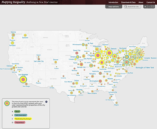
Mapping Inequality: Redlining in New Deal America 1935-1940
Redlining—or the practice of racial discrimination in housing loans—directly led to today's segregated living patterns in America. Using data from the federal Home Owners' Loan Corporation, classmates visualize the impact of policy on...
Curated OER
Maps
If your students are just starting a unit on Geography this could be the introduction you're looking for. This PowerPoint presents a clear and organized overview of the different types of maps people use and why each is important. Tip:...
Curated OER
First Grade Visits...Washington DC
Take your first graders on a virtual trip to around Washington, DC. This presentation provides illustrated slides featuring a map showing the location of Washington, DC, the White House, and some of the more famous memorials and...
Curated OER
Mapping Electricity
Students complete Internet research and use their map reading skills to learn about how the United States creates and uses electricity in different states. In this energy sources activity, students study the mini map of energy usage...
Curated OER
Facts, Fictions and Perceptions of Regions
Students examine the different characteristics of the regions of the United States. They discuss places they have visited in the U.S., and in small groups conduct research on a selected region of the U.S. Each group labels a map of...
Curated OER
Mapping Puerto Rico
Students use maps to discover where Puerto Rico is located. In groups, they use the internet to research the vegetation. They also compare and contrast the relationship between the United States and Puerto Rico's government.
Curated OER
USA: Physical Map
In this United States physical map learning exercise, learners investigate the major landforms and bodies of water located throughout the country.
Curated OER
Immigration to the United States
Students examine the reasons why people immigrated to the United States. Using maps and charts, they analyze population movements and religious affiliations. They discover how the United States became a lesser Protestant country.
Curated OER
States and Capitals, Mountains and Rivers
Students identify geographical locations in the midwestern United States. For this geography lesson, students identify 12 states and capitals and geographical features in the region by using U.S. maps. Students use blank maps to fill in...
Curated OER
Maps
Maps, globes, and computer software aid young explorers as they locate state capitols, major cities, geographic features, and attractions for states they are researching. They then use desktop publishing software to create a map to share...
Curated OER
Mapping Population Changes In The United States
Students create a choropleth map to illustrate the population growth rate of the United States. They explore how to construct a choropleth map, and discuss the impact of population changes for the future.
Curated OER
Our Land Lesson 2: Song Mapping
Students study the meaning of philanthropy as giving of time. talent, and treasures. They sing This Land Is Your Land while locating five of the places on a map of the United States showing that relief office are everywhere. They decide...
University of California
The Vietnam War (1945 – 1975)
Have you ever wanted to do something so perfectly you wound up not doing it well at all? Young historians use primary and secondary documents to analyze the United States involvement in the Vietnam War. The issues surrounding the...
Alabama Department of Archives and History
Alabama's Steps to Statehood
To demonstrate their understanding of the steps Alabama took to become a state, groups create a poster that identifies what the United States Constitution and the Northwest Ordinance required of a territory to become a state.
New York State Education Department
US History and Government Examination: August 2010
Geography has played a complex role in America history. The Atlantic Ocean has served as a buffer to protect the United States from European Wars, but its proximity to Cuba, however, left it vulnerable to nuclear war during the Cuban...
Other popular searches
- United States Maps
- United States Maps Regions
- Northeast United States Maps
- 50 United States Maps
- Create United States Maps
- Western United States Maps
- Custom United States Maps
- Outline Maps United States
- Blank United States Maps
- United States Landforms Maps
- United States Geography Maps
- United States Political Maps


