Curated OER
Central American Map
In this Central American political map worksheet, students examine the boundaries of this region of the world. The map may be used in a variety of classroom activities.
Curated OER
South east Asia and the South Pacific: Political: Labeled Map
In this Asia and the South Pacific map worksheet, students examine the boundaries of the nations in this region of the world. Students also note the location of capital cities as they are denoted by stars. This map is labeled.
Curated OER
Central America: Unlabeled Map
In this Central American political map worksheet, students examine the boundaries of the countries and capital cities located in this region of the world.
Curated OER
Central America Map
In this Central American political map activity, students make note of national boundaries and capitals in this region of the world.
Curated OER
Asia and the South Pacific: Political Map
In this Asia and the South Pacific map worksheet, students examine national political boundaries and national capitals in this region of the world.
Curated OER
Central America Region: Physical Map
In this Central America physical map worksheet, students make note of the major landforms located in this region of the world.
Curated OER
Northern Hemisphere Map
In this Northern Hemisphere polar projection map worksheet, students examine this region of the world. The continents shown are labeled.
Curated OER
Eastern Hemisphere Map
In this Eastern Hemisphere polar map worksheet, students examine the Eastern Hemisphere including the political boundaries formed by the countries in this region of the world.
Curated OER
Asia and the South Pacific : Political Map
For this Asia and the South Pacific map worksheet, learners examine the boundaries of the nations in this region of the world. Students also note the location of capital cities as they are denoted by stars. Major bodies of water are...
Curated OER
Maps
Maps, globes, and computer software aid young explorers as they locate state capitols, major cities, geographic features, and attractions for states they are researching. They then use desktop publishing software to create a map to share...
Curated OER
Weather Lesson Five
Students define a weather forecast, make a forecast using a weather map, identify three prediction guidelines, and explain how computers help to make forecasts. Students make a 24-hour forecast for each of the thirteen states targeted.
Curated OER
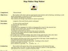
Map Maker, Map Maker
Map maker, map maker, make me a map! Your class can sing this tune as they work to create their own regional maps by taping paper to the wall, projecting an overhead transparency image, and tracing. Where this lesson plan intends for the...
Curated OER
Across the United States- Home Learning Activity
In this home-school United States map learning exercise, students work with a family partner as they study a map of the United States. They talk about the states they have visited, play a game by giving each other clues about states, and...
Curated OER
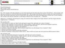
WWI for World History Honors
Using a textbook, learners will examine various aspects related to the Triple Alliance of WWI. They complete a series of handouts, engage in a class discussion, and interpret a map showing both the Triple Alliance and the Triple Entente....
Curated OER
Early European Explorers Map
Fifth graders create an explorer's map. In this explorers lesson students use a map of the world as reference to draw their own map of Europe, North America, Central America, and the Caribbean Islands. The students use their maps to show...
Roald Dahl
Matilda - The Reader of Books
The titular Matilda from Roald Dahl's famous novel adored books above all things. Discuss why it is important to read stories from across cultures and around the world using the first chapter from the ever-loved story Matilda.
Curated OER
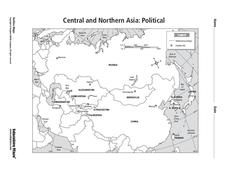
Central and Northern Asia: Political
In this Central and Northern Asia map worksheet, students examine national political boundaries and national capitals in this region of the world. The map is labeled.
Curated OER
Southern Hemisphere Map
In this Southern Hemisphere polar projection map worksheet, students examine this region of the world. The continents shown are labeled.
Curated OER
Eurasia Physical Map
In this Eurasia physical map activity, students make note of the major landforms and bodies of water located in this world region.
Curated OER
Rivers, Maps, and Math
Students use maps to locate and label the major rivers of North and South America. Using the internet, they identify forests, grasslands, mountain ranges and other landforms on the continents as well. They compare and contrast the...
Curated OER
Geomnemonics: Facilitating the Teaching of Social Studies Content with Geography Skills
Students explore how to draw a world map by hand and how to locate countries.
Curated OER
Organization of a Territory, Map Elements
Third graders compare printed and online maps and use proper geographic terminology to answer questions.
Curated OER
Weather Maps
Students interpret information on a weather map in order to construct a graph, and discuss how the weather impacts their lives.
Curated OER
Things That Stick Out Or: How To Find Your Way Around on a Map
Students explain the meaning of and recognize the map outlines of a peninsula, an isthmus, and a cape.
Other popular searches
- World Outline Maps
- World War I Outline Map
- Blank World Outline Maps
- World Outline Political Map
- World Climate Map Outline


