Curated OER
Operation Immigration
Fifth graders create a digital scrapbook depicting the life and journey of an immigrant to the United States. Individuals will use the internet as a tool to research immigration in the U.S., and videos and guest speakers help students...
Curated OER
Follow the Light
Here is another in the interesting series of lessons that use the special State Quarters as a learning tool. During this lesson, pupils learn about lighthouses, maps, the cardinal directions on a compass, and U.S. geography. There are...
Curated OER
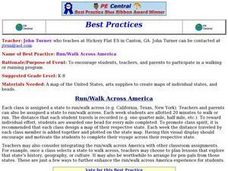
Run/Walk Across America
Walk, jog, or run across America. Maps of individual states, visual progress, competition, and rewards, seem to be great motivational ideas. Make sure that the distances that each class has to walk or run are the same, because getting...
Curated OER
Making a Report to President Washington
Learners gain an understanding of some of the challenges the U.S. faced at its birth. They are asked to compose a report on the state of the nation in 1790 (addressed to President George Washington), which includes a narrative, maps and...
Angel Island Immigration Station Foundation
Where Is Angel Island? An Introductory Geography Lesson
Prepare young historians for a study of Angel Island Immigration Station with a lesson examining primary and secondary source materials, maps, and websites. Using what they have learned, individuals create a map of Angel Island, labeling...
College Board
2015 AP® Human Geography Free-Response Questions
How are population and political power related? What is the significance of the globalization of English? Why do refugees leave their home countries? Using structured short-answer questions, scholars unravel complicated dynamics with...
Curated OER
Getting to the Core of World and State Geography
Students create topography relief maps. In this geography skills lesson, students review geography core knowledge skills, design and make a state relief map, and compile a student atlas.
Curated OER
United States Capitols Word Search Puzzle
In this geography word search instructional activity, students locate the names of the 50 state capitols that are hidden in the puzzle. They use the names that are found at the bottom of the page in a word bank.
Curated OER
The 50 States
Fifth graders use maps and music to learn the 50 states. In this US Geography lesson, 5th graders map out a region of the United States and practice singing the song, The 50 States that Rhyme.
Curated OER
4th Grade Geography Multiple Choice
In this grade 4 geography worksheet, 4th graders complete a total of 25 multiple choice questions relating to 4th grade geography concepts. An answer key is provided.
Curated OER
Let Me Tell You About My State
Fifth graders research one of the 50 U.S. States that they were unfamiliar with. In this U.S. Geography activity, 5th graders utilize encyclopedias as well as the Internet to research a chosen U.S. State in order to write a report....
Curated OER
Overland Trails To The West
After observing a map of trails that settlers took in the 1800s, your class will write a journal with the perspective of a settler. In their journals, they must describe the trail they traveled, geographical features they saw, states and...
Curated OER
Mapping Your State's Role in the Vietnam War
Students recognize reasons to celebrate Memorial Day. Students create a map of victims of the VIetnam War. Using the internet, students research information about soldiers from their state who were killd in action in Vietnam. Students...
Curated OER
Rockin' Round New York State
Students discuss their favorite rock groups and bands. They create rock groups that will be touring New York State. Students research cities in New York, determine dates of concerts, create touring itineraries, and develop Inspiration...
Curated OER
Geography, Climate, and Community in the Dominican Republic
Students familiarize themselves with the geography and culture of the Dominican Republic. In this Dominican Republic lesson, students use the given scenarios as starting points to analyze the geography and culture of the Dominican...
Alabama Department of Archives and History
Conflict in Alabama in the 1830s: Native Americans, Settlers, and Government
To better understand the Indian Removal Act of 1830, class members examine primary source documents including letters written by Alabama governors and the Cherokee chiefs. The lesson is part of a unit on the expansion of the United...
University of Richmond
The Forced Migration of Enslaved People 1810-1860
Slavery not only involved the forced migration of African people from their homes, it also meant the forced removal of people within the United States. Using data and interactive graphics, scholars see how the tragedy of human slavery...
Scholastic
Volleyball Road Trip
Review coordinate mapping with your young geographers by matching cities on a volleyball team's road trip itinerary to their appropriate coordinate locations.
PBS
What's In a Name?
What is in a name? Eager historians trace the geographical history of places in the United States with Spanish names. Using a worksheet activity, clues, and web research developed in conjunction with the PBS "Latinos in America" series,...
PBS
The Media and the War: The Penny Press, Walt Whitman and the War
The Mexican-American war marked a significant moment in United States history, as well as in the history of American media. The mid-nineteenth century saw the introduction of the Penny Press, which provided many American citizens with...
Curated OER
Louisiana State Word Jumble
In this word jumble worksheet, students unscramble the letters to spell words associated with the state of Louisiana. Students spell 20 words.
Curated OER
United States Map - Lesson 9
Students explore the concept of cardinal directions. In this geography lesson, students identify the compass rose on a large U. S. map and then discuss the cardinal directions.
Curated OER
Eastern States Word Search
In this geography word search instructional activity, students locate and circle the 13 states located in the Eastern region of the United States. A word bank is provided.
Curated OER
Western States Word Search
In this geography word search worksheet, students locate and circle the 11 states located in the Western region of the United States. A word bank is provided.
Other popular searches
- Geography of United States
- Geography United States
- Geography of the United States
- United States Geography Unit
- Physical Maps United States
- United States Geography Maps
- United States Geography 4 6
- Picture United State Maps
- Physical Maps of United States


