Annenberg Foundation
Antebellum Reform
Scholars investigate the Antebellum period in the United States in an engaging lesson. Groups analyze technological, religious, economic, and social changes occurring during the time period prior to the Civil War. Using their new...
Houghton Mifflin Harcourt
Animal Adventures: Challenge Activities (Theme 6)
Challenge learners who have mastered the basic concepts in the Houghton Mifflin Harcourt thematic units on animal adventures with the activities and exercises suggested in this packet packed with ideas.
Curated OER
Special Traits: Alabama quarter reverse
Who knew a state quarter could say so much? Alabama's quarter is embossed with an image of Helen Keller, pupils will use this image to think about what the phrase "Spirit of courage" means. They will use a graphic organizer to...
Curated OER
Amazing metals: Nevada quarter reverse
Nevada's nickname is "The Silver State" and metal is what this lesson is all about. Pupils will make a T-chart to discuss the differences between metals and minerals, then write and explain the properties of metal. They will get into...
Curated OER
Push or Pull?
Utilizing the Nebraska State Quarter, pupils learn about the pioneers who had wagons that were pulled across Nebraska by oxen during the westward movement. Excellent worksheets are embedded in the plan that guide them through this fine...
Smithsonian Institution
We Have a Story to Tell: Native Peoples of the Chesapeake Region
How did colonial settlement and the establishment of the United States affect Native Americans in the Chesapeake region? Your young historians will analyze contemporary and historical maps, read informational texts, and work in groups to...
California Academy of Science
California's Climate
The United States is a large country with many different climates. Graph and analyze temperature and rainfall data for Sacramento and Washington DC as you teach your class about the characteristics of Mediterranean climates. Discuss the...
Classics for Kids
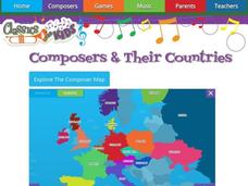
Composers and Their Countries
How many of the world's greatest composers were born in Austria? Or Germany? Or the United States? An interactive map provides young musicians with information about prominent composers in the last few centuries, as well as the periods...
Curated OER
Understanding Stereotypes
Pupils confront age-related stereotypes, explore how stereotyping impacts their lives, and discuss how they can make changes to reduce over-generalizations, unfair assumptions, and critical judgments about people groups. They use a...
Curated OER
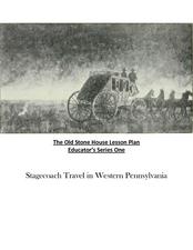
Old Stone House Lesson Plan
From stagecoach to railroad tracks, your class will discover how advancements in travel in the United States during the nineteenth century played an integral role in the industrialization and development of American society. The main...
All for KIDZ
The Orphan of Ellis Island
Everyone comes from somewhere. An interdisciplinary lesson on Elvira Woodruff's The Orphan of Ellis Island includes discussion starter and writing prompts for the novel, as well as a graphic organizer to help learners begin their own...
Missouri University of science & Technology
General Overview History of the Panama Canal
Called the Eight Wonder of the World by some and the Big Ditch by others, the Panama Canal is indeed an engineering marvel. The long, complicated, and sometimes controversial history of the canal is captured in a presentation loaded with...
American Battle Monuments Commission
Honoring Service, Achievements, and Sacrifice: A WWI Virtual Field Trip
The largest offensive in United States military history comes alive in a online interactive resource. Young historians explore the Meuse Argonne battlefield and scour the landscape for evidence from the battle. They then use primary...
Curated OER
I Can Find that Where? - A Study of Landforms
First graders make landform maps of the United States. In this landform lessons, 1st graders participate in a discussion of local landforms and make a landform map of the United States. They follow the teacher's directions to add plains,...
Curated OER
U.S. Geography for Children: The Northeast
In this map skills of the northeastern United States worksheet, students observe an outline map, locate and label the states, and designated landforms and bodies of water; and create symbols and a map key for sources of economy and other...
Curated OER
Rock Around the Map
Students research the geographical histories of various musical genres and make maps that note important places in music history. They Write geographical biographies about one of their favorite musical artists.
University of New Mexico
New Mexico Land of Enchantment
Third graders research Native American Cultures surrounding New Mexico. They analyze the history and geography of the state. They play a guessing game that incorporates the indigenous plants and animals of New Mexico. In groups, learners...
Texas State Energy Conservation Office
Investigation: Tour de Texas
Teams of Texas tourists gather into groups to analyze what they can do with $50 worth of an alternative fuel. They write checks, keep a balance sheet, and map out their sight-seeing route taking into consideration the location of...
Baylor College
People and Climate
Model how the sun's energy strikes the planet and help your class relate it to a climate map. Assign small groups an individual climate zone to discuss. They reflect on and research how humans survive in the assigned climate and write a...
Baylor College
Pre-Assessment Activity: What Do You Know About Microbes?
In an introductory lesson, youngsters take a pre-assessment quiz, get a grasp of a gram of mass, and then estimate the mass of microorganisms that live within a human body. Using Glo Germ™, a material that allows you to simulate the...
Curated OER
ADULT ESOL LESSON PLAN--Environment and the World
Students locate and trace Florida on a United States map as well as their local counties and city of residence on a state map. In addition, they label all the directions north, south, east and west on each map.
Curated OER
Precipitation Map
In this precipitation map worksheet, students study the key and the map for the various precipitations that occur across the United States. Students then answer questions about the precipitation.
Curated OER
Exploring United States V. Hirabayashi
Students review the case of the United States V. Gordon Hirabayashi. Students order the events leading up to the Hirabayashi case on a timeline and analyze the final decision, including identifying any alternative outcomes.
Curated OER
The Power of Maps & Native American Cultures
Sixth graders discover where and how five Native American cultures lived in North America in what is currently the United States. They examine their way of life and the regions they inhabited. Additionally, 6th graders will understand...
Other popular searches
- United States Maps Regions
- Northeast United States Maps
- 50 United States Maps
- Create United States Maps
- Western United States Maps
- Custom United States Maps
- Outline Maps United States
- Blank United States Maps
- Maps, United States Rivers
- Maps United States Capitals
- Maps of the United States
- Maps United States


