Curated OER
Race and Ethnicity in the United States
Students explore race and ethnicity as it is defined by the U. S. Census Bureau. They compare data from 1900, 1950, and 2000 and identify settlement patterns and changes in population. In groups, they map these changes and discuss...
Curated OER
Puerto Rico: The 51st State?
Students explore Puerto Rico. For this Puerto Rico current events lesson, students conduct a Webquest to answer questions about Puerto Rico's culture. Students discuss whether Puerto Rico is a country or a state, and defend...
Curated OER
War of 1812: Map and Label
Map test! Hand out this map of the East Coast of the United States and let learners mark each of the nine sites listed. They'll be making a map that shows the battle sites and areas involved in the War of 1812. Great as a test or as a...
Curated OER
The 50 States and its Holidays
Though the format of this ELL lesson plan is confusing (the standards listed are for plate tectonics, yet the objectives are for American geography and holidays), a teacher could glean some ideas from the main idea. Here, pupils complete...
Reporters Without Borders
2017 World Press Freedom Index
Freedom of the press was seen as a right so important that the Founding Fathers listed it as part of the first amendment to the United States Constitution. Americans pride themselves on this freedom, but just how free are American...
Curated OER
Our 50 States
Students identify the location of the 50 states using an interactive map. They practice geography skills by playing a fun game. Pupils become familiar with the state abbreviations for the US states. Students become familiar with the...
Curated OER
U.S. Political Map
In this political map learning exercise, learners use the map of the United States and the 7 cities to measure the straight-line distance between the cities. Students add the total number of miles traveled and write their answers in the...
Curated OER
USA: Average Precipitation and Temperature Map
In this United States map learning exercise, students make note of the average precipitation and temperature in regions of the country.
DocsTeach
Lewis and Clark's Expedition to the Complex West
Lewis and Clark's famous expedition is a prime example of the United States' westward expansion. Aspiring historians examine maps from Lewis and Clark's journey, as well as discuss their interactions with Native American tribes. The...
National Endowment for the Humanities
The Creation of the Bill of Rights: “Retouching the Canvas”
While the Constitutional Convention lay the foundation of the new government for the United States, the protections given under the Bill of Rights were controversial. Using documents, such as James Madison's and Thomas Jefferson's...
University of California
The Civil War: Secession of the South
Was the Southern states' decision to secede from the Union protected by the United States Constitution? Eighth graders discuss the constitutionality of the South's justification for secession, particularly the secession of South...
New York State Education Department
US History and Government Examination: June 2018
Ready to test your learners about anything and everything related to United States history and government? The resource uses multiple-choice and essay questions to assess knowledge.
Curated OER
Utah: State History
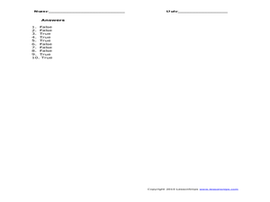
In this Utah state history worksheet, learners read two and a half pages of information about Utah and complete 10 true and false questions.
Curated OER
The Great States Race
Here is another in the interesting series of lessons that use the special State Quarters as a learning tool. This one uses the Indiana State Quarter. During this lesson, utilize a brilliantly-designed board game that is embedded in the...
Curated OER
Weather Pals
Learners study maps of the United States to locate weather pals from a list of schools. They communicate with Weather Pal schools through the use of closed circuit TV. Using weather data collected in their area, they exchange the...
Curated OER
Soil: Food Mapping
Students examine the concept of food mapping . In this agriculture lesson plan, students explore food and agriculture systems in the United States in the past and today. Students complete food mapping activities.
Curated OER
United States Map
Students compare the United States on a globe and on a map. In this map lesson, students relate the sizes of the continents and locate the United States. Students identify the location of the continental US as well as Alaska and Hawaii.
Curated OER
Map Study
For this geography worksheet, students study the United States. Students respond to 6 multiple choice questions about the map.
Curated OER
17 states
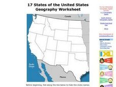
In this states instructional activity, students label states in the United States that are on the west side of the country. Students label 17 states.
Curated OER
Bunyans Lesson Plan
Learners practice their map skills. In this early childhood lesson plan, students use a map of the United States and identify the location of several natural wonders included in the book The Bunyans by Audrey Wood.
Curated OER
Where the Parks Are
Students research major league baseball in United States and Canada. In this baseball history lesson, students use a map of the United States and Canada to find and label each major league team. Students then color the home cities of the...
Curated OER
USA: Physical Map
In this United States physical map learning exercise, learners investigate the major landforms and bodies of water located throughout the country.
Curated OER
States in the USA Quiz
In this online interactive geography quiz worksheet, students respond to 50 identification questions about the states in the United States of America. Students have 4 minutes to complete the quiz.
US Mint
Symbols in My Eyes
Explore the hidden meanings behind the images on US currency with this elementary school lesson on symbolism. Starting with a class discussion about symbols, children go on to brainstorm different objects that represent the Unites...
Other popular searches
- United States Maps Regions
- Northeast United States Maps
- 50 United States Maps
- Create United States Maps
- Western United States Maps
- Custom United States Maps
- Outline Maps United States
- Blank United States Maps
- Maps, United States Rivers
- Maps United States Capitals
- Maps of the United States
- Maps United States


