Geophysical Institute
Latitude and Longitude with Google Earth
Travel the world from the comfort of your classroom with a lesson that features Google Earth. High schoolers follow a series of steps to locate places all over the earth with sets of coordinates. Additionally, they measure the distance...
It's About Time
The Electricity and Magnetism Connection
Magnets don't grow in fields, but magnetic fields are important to understand. The lesson covers the effect electricity has on magnetic fields. Scholars use a compass, magnets, and electrical wire to test magnetic fields and energy...
Common Sense Media
The Masque of the Red Death
Poe goes high tech with a lesson that asks high schoolers to use the internet and various apps as they read and analyze "The Masque of the Red Death." In addition to responding to comprehension questions in Quizlet, they use Minecraft to...
Smithsonian Institution
Borders with the World: Mexican-American War and U.S. Southern Borderlands
The Mexican-American War created social borders—not just physical ones. Scholars learn about the effects of the Mexican-American War on the people living in the borderlands using text excerpts, maps, and partnered activities. Academics...
K12 Reader
Meteorologists
Meteorologists and the tools they use are the subject of a reading comprehension worksheet that asks kids to read the attached article and respond to a series of comprehension questions.
Prestwick House
Lord of the Flies
Nothing about William Golding's Lord of the Flies is straightforward, but you can map out the characters and key details in a helpful crossword puzzle. Twenty-seven clues review the book in an engaging and fun way.
Core Knowledge Foundation
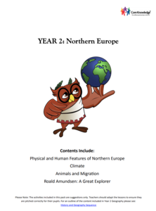
Year 2: Northern Europe
How is life in Northern Europe different from other areas of the world? Historians journey through the various regions of Northern Europe discovering what type of climate, animals, and lifestyles exist in that section of the world. They...
K12 Reader
Colonization: for Gold, God, and Glory
Colonization, cartography, and circumnavigation. After reading a short article about early explorations, kids use the information provided to answer a series of comprehension questions.
K12 Reader
Conflict Over North American Lands
Readers are introduced to some of the conflicts that arose over land and resources in the Americas in a two-part cross-curricular comprehension worksheet that asks kids to study the article and then to use information provided to...
British Council
Weather 1
Match weather words with pictures in a weather vocabulary learning exercise. Beginning readers look at pictures of various weather patterns and choose/write the word that describes the weather. They create a map and write about the...
Mathematics Vision Project
Circles: A Geometric Perspective
Circles are the foundation of many geometric concepts and extensions - a point that is thoroughly driven home in this extensive unit. Fundamental properties of circles are investigated (including sector area, angle measure, and...
Australian Government
The Great Artesian Basin
Covering 23% of the continent and holding 64,900 cubic kilometers of water, the Great Artesian Basin is the primary source of water for much of inland Australia. Using detailed student worksheets, experiments, and case studies,...
US Navy
The Science of Diving
Introduce gas laws using the popular topic of SCUBA diving. This activity makes a connection between the gas laws and the effect of pressure and temperature changes during diving. Young engineers complete introductory experiments to...
EngageNY
Angles Associated with Parallel Lines
Explore angle relationships created by parallel lines and transversals. The 13th lesson of 18 prompts scholars use transparency paper to discover angle relationships related to transversals. Learners find out that these angles pairs are...
Illustrative Mathematics
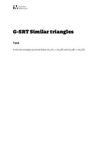
Similar Triangles
Proving triangles are similar is often an exercise in applying one of the many theorems young geometers memorize, like the AA similarity criteria. But proving that the criteria themselves are valid from basic principles is a great...
EngageNY
Modeling an Invasive Species Population
Context makes everything better! Groups use real data to create models and make predictions. Classmates compare an exponential model to a linear model, then consider the real-life implications.
Chicago Botanic Garden
Albedo, Reflectivity, and Absorption
What is reflectivity, and what does it have to do with the Earth's climate? As reflectivity is measured by albedo, scientists can gather information on Earth's energy balances that relate to global warming or climate change. Budding...
Curated OER
Geography Journey
Fourth graders examine the geographic features that define places and regions and answer questions about the state of California. They discuss the components of a map legend and answer worksheet questions using a map of California as a...
Curated OER
We Found It!
First graders identify and describe landforms. They demonstrate an understanding of the compass rose and a map key using the trail of Lewis and Clark and the Corps of Discovery. They generate a map key.
Curated OER
Places in My World
Second graders explore where they are located on the globe. In this maps and globes lesson, 2nd graders use a map to show where they live and show the cardinal directions. Students identify characteristics of mountains, flat land,...
Curated OER
Are We There Yet?
Students discover how to use maps and why they are important when using a map. They calculate distance using a map scale and time using travel speed and a map scale.
Curated OER
Country Capitals
Young scholars locate country capitals on a world map. In this map skills lesson, students review the definition of the word country and discuss what a capital is. Young scholars locate and label capital cities on a world map using a map...
Curated OER
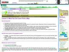
What You Can Learn From a Map
Learners investigate the use of road maps, shadeded relief maps, and topographic maps.
Curated OER
Introduction to Maps
Students investigate a variety of maps to explain what each one is used for.


