Curated OER
Water Resources
Learners explore the differences between surface water and ground water. They collect data using maps and graphs and investigate a Texas river basin and a nearby aquifer. They complete a written report of their findings regarding the...
Curated OER
"Global Relations"
Students explain the difference between each of three major ecosystems. They determine the flow of water in the St. Mary's River as it flows out of the river into the bay, and finally out into the Atlantic Ocean and identify where...
Curated OER
Oak Ridges Moraine: Southern Ontario's Sponge
Students examine the characteristics of the Oak Ridge Moraine in Canada. Using a map, the locate the moraine and present and defend a position on how the resources found there should be used. They must use proper geography terminology...
Curated OER
Riparian Review
Students engage in the process of researching a riparian ecosystem. They conduct a field trip in order to obtain different types of data and work on measurement skills to analyze data to form a conclusion about the biotic factors of the...
Curated OER
Pollutants and Contaminants
Students define pollution and contaminants by constructing a Definition and Concept Trail that illustrates how they are connected to health. They give examples of health issues during the Industrial Revolution by conducting textbook...
Curated OER
Science: Not just Gold
Pupils articulate a possible relationship between arsenic and gold deposits in a written statement using data to substantiate the relationship they describe. They use real data to determine the source of the arsenic in the drinking water.
Curated OER
How Clean Is Our Water?
Students examine samples of water to determine its cleanliness. They visit a waste treatment plant and/or reservoir. Students explore what protects the water supply from contamination by chemical or organize pollution. They trace the...
Curated OER
Ecology
Middle schoolers examine the relationship between the environment and those that have to live in it. They discover that we are responsible for our environment and understand the consequences of its neglect.
Curated OER
Locating the Salt Front
Young scholars use Hudson River salinity data to create a line
graph that shows the location of the salt front, and use math
skills to explore how this location varies over time. They use the graph to estimate the location of the salt...
Curated OER
Life in Extreme Environments - Lakes Under Ice
Students collect chemical, physical, and biological data from a local lake throughout the year. In addition, students discuss the design of an experimental structure for water collection at several specific depths as well as assess the...
Curated OER
Is it Alive?
Students watch a demonstration using Duco glue and water and try to determine if the "monster" shown is alive. After the demonstration, they discuss what characteristics make an organism "alive". They participate in a card sorting...
Curated OER
How Much Do I Know About Water?
Sixth graders explore ways to analyze the properties of water and examine the chemistry of water. In this water lesson students work in groups and complete several activities.
Curated OER
How Much Do I Know About Water?
Sixth graders explore how water behaves on a penny. In this states of matter instructional activity, 6th graders observe water as they add drops to a penny. This instructional activity helps students apply the adhesive properties of...
Curated OER
Introduction to the Barnegat Bay Estuary
Students research estuaries. In this estuaries lesson, students discuss the differences in a bay and an ocean. Students watch a PowerPoint of the properties of the estuaries and geography of Barnegat Bay. Students complete a worksheet...
Curated OER
Breaking News English: India-Pakistan Bus Service Resumes after 58 Years
In this English activity, students read "India-Pakistan Bus Service Resumes after 58 Years," and then respond to 47 fill in the blank, 7 short answer, 20 matching, and 8 true or false questions about the selection.
National Geographic
National Geographic: Mapping the World's Watersheds
In this lesson, students use a world map to locate and label major rivers and their watersheds. They then compare watershed shapes and look at typographical features that determine their shapes. A vocabulary list with definitions is...
National Geographic
National Geographic: Visualizing Watershed Health
Using data visualizations that show dissolved oxygen levels, students analyze the health of the Chesapeake Bay watershed. They will also learn about dead zones, which are aquatic areas where there is insufficient oxygen to support life....
National Geographic
National Geographic: Exploring Place in the Chesapeake Bay Watershed
In this activity, students use the National Geographic FieldScope to examine the Chesapeake Bay watershed and its tributaries, and learn how their location connects to it. They then develop a watershed profile for their location....
National Geographic
National Geographic: Mapping u.s. Watersheds
Students will identify and explore major rivers and watersheds in the United States.
US Geological Survey
Us Geological Survey: Watersheds
Learn all about watersheds in this text based article. What are they? Where are they found? What purpose do they serve?
US Geological Survey
Usgs: The Water Science School: Watersheds and Drainage Basins
Understand what watersheds are and the purpose of drainage basins. This is a resource designed to enrich classroom learning about the science of water.
PBS
Pbs Learning Media: Ways of Watersheds
Learn about the four phases of the water cycle, the ways in which watersheds are crucial to healthy water, and the best ways to manage local watersheds with this interactive lesson.
Discovery Education
Discovery Education: Homework Helper: What Is a Watershed?
This video describes what watersheds are and where they are located. View several different watersheds and learn how their flow is affected by the topography around them. [7:11]
TeachEngineering
Teach Engineering: Watershed Balance
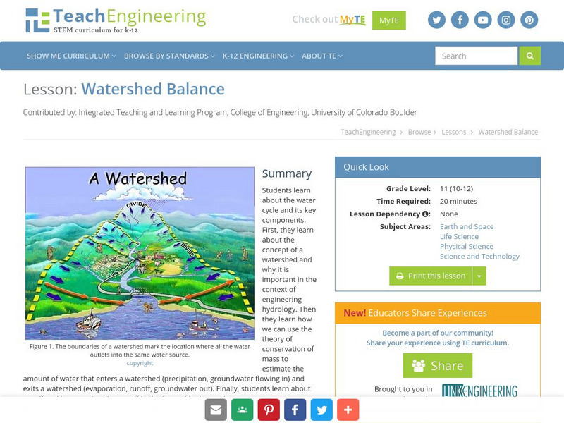
This lesson teaches the concept of a watershed and why it is important in the context of engineering hydrology. Learners learn about runoff and how we visualize runoff in the form of hydrographs.
Other popular searches
- Mississippi River Watershed
- Chesapeake Bay Watershed
- Watershed Hydrology
- Watershed and Water Quality
- Watersheds and Wetlands
- Watershed and Drinking Water
- Great Lakes Watershed
- Apalichicola River Watershed
- Delineate a Watershed
- Watershed Management
- Virginia Watersheds
- Pennsylvania Watersheds


