Curated OER
Most Livable Cities Quiz
In this online interactive geography quiz worksheet, students respond to 20 identification questions about the most livable cities in the world. Students have 4 minutes to complete the quiz.
Curated OER
Chinese Cities Map Quiz
In this online interactive geography quiz instructional activity, students respond to 10 identification questions about Chinese cities. Students have 3 minutes to complete the quiz.
Curated OER
Monarchies of the World Quiz
In this online interactive geography quiz worksheet, students respond to 27 identification questions about the locations of monarchies. Students have 4 minutes to complete the quiz.
Curated OER
World Currency Quiz
In this online interactive geography quiz instructional activity, students respond to 81 identification questions about world currencies. Students have 10 minutes to complete the quiz.
Curated OER
Biggest Muslim Cities Quiz
In this online interactive geography quiz worksheet, learners respond to 34 identification questions about the largest Muslim cities. Students have 5 minutes to complete the quiz.
Curated OER
Country Shape Quiz #4
In this online interactive geography quiz worksheet, students respond to 16 identification questions regarding the shapes of countries of the world. Students have 4 minutes to finish the timed quiz.
Curated OER
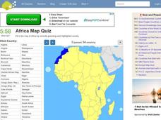
Africa Map Quiz
In this online interactive geography quiz worksheet, students respond to 53 identification questions about the countries of Africa. Students have 6 minutes to complete the quiz.
Curated OER
Walking for Water Mini-Unit
Students participate in an activity that requires them to consider the availability of water. In this "walking for water" lesson, students read "Women Bear the Weight of Water," and respond to discuss questions regarding the article....
Curated OER
Things w/ Geographic Names Quiz
In this online interactive geography quiz worksheet, students respond to 31 identification questions about products or things with geographic names. Students have 4 minutes to complete the quiz.
Curated OER
I Can Compass, Can You?
Young scholars discover how to use geographic tools. In this compass lesson, students identify cardinal directions by appropriately using compasses along with a number of various maps.
Curated OER
Illinois State Map
For this Illinois geography worksheet, students color and label a map of Illinois. Students study the location of the capital and where Illinois is situated in the United States. There is a black line map of the state with a grey US map...
Curated OER
Internet Search Practice 2
For this internet search worksheet, students use a search engine to find the answers to 7 questions. They answer questions about geography, mammals, US history, and word work.
Curated OER
Mapping Districts
Students become literate in their use of maps. In this 2010 Census lesson plan, students visualize census data on maps, use map keys to read population maps, and explore the concept of population density.
Curated OER
Mapping Districts
Students use maps to learn about the U.S. Census. For this 2010 Census lesson plan, students visualize census data on maps, use map keys to read population maps, and explore the concept of population density.
Curated OER
Lesson 2: Mapping Sub-districts
Students learn more about the census. In this mapping sub-districts lesson plan, students visualize census data on a map, use a map key to read a population map, and better understand the concept of population density.
Curated OER
Europe at Exploration 1500
In this world empires and trade in 1500 worksheet, students examine a world empire map, world trade map, and Europe map. All maps display information from 1500.
Curated OER
Europe 1914
In this Europe 1914 map worksheet, students note the 9 regions of the Europe labeled on the map and their relevance to World War II.
Curated OER
Australia: Introductory Lesson
Students explore Australia. In this global studies lesson plan, students listen to audio clips and watch video clips that introduce them to the the nation-continent. Students discuss what they already know about Australia and what they...
Curated OER
Visit Burma, the Safe Way
Students virtually travel to Burma. In this Burma lesson, students research Burma's history, religion, and current events as they visit selected websites and share their findings.
Curated OER
Mapping The Way With Lewis & Clark
Fourth graders analyze and compare maps used on the expedition of Lewis and Clark. Students write reports about the geography of the land. They answer questions about Lewis & Clark.
Curated OER
Beijing: An Important City in China
Students investigate Beijing by reading an essay. In this Chinese Geography lesson, students read an essay written about Beijing and answer questions on a comprehension worksheet. Students may research Beijing further by...
Curated OER
Mensa For Kids: The Moon
First graders explore space science by completing an arts and crafts activity. In this moon lesson, 1st graders explore the geography of the moon and discuss the importance it has for people living on Earth. Students create a replica...
Curated OER
Places in Arkansas: A Tour of Our Unique State
A great instructional activity focuses on important cultural and historical places in the state of Arkansas. Learners are introduced to six important places in Arkansas, then create a report on a place in Arkansas. Some excellent...
Curated OER
The Arkansas State Flag
Young historians take a look at the history of the Arkansas state flag. Pupils color, cut, and paste together their own versions of the flag. They learn about the meaning of the flag's colors, and what the various symbols on the flag...
Other popular searches
- Us Geography
- Canada Geography Land Use
- Us and Canada Geography
- Us Geography Climate
- Us Geography Skills
- Usa Geography Map Skills
- Us Geography Pdf
- Us Geography Scavenger Hunt
- Us Geography Northeast
- Us Geography Activity
- Us Geography Slavery
- Us Cultural Geography


