Curated OER
Exploring Arizona's Biotic Communities Lesson 1: Mapping Biotic Communities
As part of a unit on Arizona's biotic communities, young ecology learners create a map. They describe how humans and animals adapt in their habitat. They take notes and create graphic organizers from articles they read. Beautiful maps,...
Curated OER
Unit V: Worksheet 2 - Constant Force
Physics learners studying force and acceleration practice solving eight problems with this assignment. They calculate acceleration and deceleration, net force, and distances required for stopping a moving object. Kinematics equations and...
Curated OER
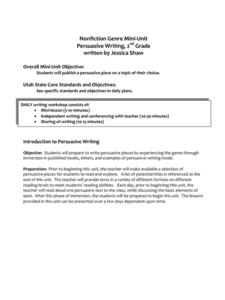
Nonfiction Genre Mini-Unit: Persuasive Writing
Should primary graders have their own computers? Should animals be kept in captivity? Young writers learn how to develop and support a claim in this short unit on persuasive writing.
University of Richmond
Canals 1820-1860
While canals are not a common mode of transportation today, they were part of the fuel for America's industrialization. However, most of them were located in the North, also feeding regional differences and sectionalism. Using an...
Curated OER
United States Map: March 31
In this calendar dates worksheet, students learn that March 31st was the day the first map of the United States was published. Students then create a map of either their classroom or school.
Curated OER
River Run Through It
With vocabulary lists, worksheets, and more, this lesson sets learners on an exploration of the Hudson River area. They read an essay about the area, analyze a relief map of New York State, and complete a worksheet.
Curated OER
Rivers Run Through It
Using a relief map of New York State, learners answer questions about the distance between different cities, identify bodies of water, and more. First, they discuss vocabulary related to the Hudson River area. Then, they complete a...
Curated OER
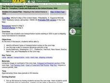
Shipping in the United States in 1835
Students use transportation routes existing in 1835 to plot a shipping route from Boston to Cincinnati. They use the map scale to measure distances and plot a trip.
Curated OER
U.S. Puzzle Map Bulletin Board
Students create cutouts of each state. They research different states noting their similarities and differences. They describe each state's location in relation to the state's surrounding them.
Curated OER
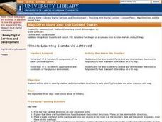
Map Directions and the United States
Third graders search TDC database for images of a compass rose, a miles marker, and a US map. They identify cardinal and intermediate directions to help identify their state and other states on a US map.
Curated OER
Treasure Hunt!
Students follow directions on a worksheet to follow directions on a map of the United States and Territories of the United States. In this directions worksheet, students use a compass rose and learn the directions.
Curated OER
Rice Farming History
Second graders map the progress of rice farming by using a map of the United States. In this rice farming lesson plan, 2nd graders draw a line on the map from where rice farming started to the progression of its growth.
Curated OER
The World (With an emphasis on the United States)
Fourth graders recognize the different continents. They are introduced to longitude and latitude and how to find locations using these measurements. This series ends with an emphasis on the fifty states of the United States and their...
Curated OER
The Louisiana Purchase: Worksheet
Celebrate the anniversary of one of the United States' most important land acquisitions with a fun worksheet. The class answers five matching questions related to those involved with the Louisiana Purchase and then think about what life...
Newark Public Schools
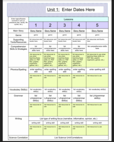
ELA Curriculum Map
Organize your curriculum of narratives and stories within an ELA unit and keep track of what elements are needed to ensure the unit's success. This curriculum map template allows you to plan for supporting texts, comprehension skills and...
Carolina K-12
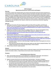
Who the People? Representative Democracy in North Carolina and Congress
Our elected officials are supposed to represent us, but what does it mean when they aren't like us? Budding citizens explore the demographic makeup of the US Congress, the role of money in political elections, and the Citizens United...
Scholastic
Perfect Postcards: California
It's time to hear about some adventures in travel! The Transcontinental Railroad changed life and travel in the United States during the 1800s. Practicing online research skills, pupils discover the features they would like to visit on...
Curated OER
The Great Military: Map of Texas
The battle at the Alamo may be one of the most famous military campaigns in Texas history, but it is by no means the only one. As part of their study of the military history of Texas, class members research less-well-known sites, locate...
Science Matters
Ring of Fire
Over a period of 35 years, earthquakes and volcanoes combined only accounted for 1.5 percent of the deaths from natural disasters in the United States. The 15th lesson in a 20-part series connects the locations of earthquakes and...
Chicago Botanic Garden
Unit 2 Pre-test, Grades 7– 9
This pre-assessment launches a unit on climate change and weather. 15 questions, both short answer and multiple choice, asses the classes' knowledge about these concepts.
Curated OER
Sunny Symbols
After listening to a series of stories about signs and symbols associated with the United States, pupils discuss the importance of the sun in Native American legends and as a representation of New Mexico. As part of this exploration,...
Curated OER
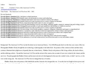
A Soldier's View of the American Civil War
Study and research the American Civil War in this explanatory writing lesson. Middle schoolers complete six activities to learn about the American Civil War and soldiers' views of the war. The lesson includes several options to complete...
San Antonio Independent School District
The Not So Big Book of Westward Expansion
From the thirteen colonies to the Mexican cession, your learners will track the territorial acquisitions made by the United States during eighteenth and nineteenth centuries with this printable booklet.
PBS
What's In a Name?
What is in a name? Eager historians trace the geographical history of places in the United States with Spanish names. Using a worksheet activity, clues, and web research developed in conjunction with the PBS "Latinos in America" series,...
Other popular searches
- United States Maps
- United States Maps Regions
- Northeast United States Maps
- 50 United States Maps
- Create United States Maps
- Western United States Maps
- Custom United States Maps
- Outline Maps United States
- Blank United States Maps
- United States Landforms Maps
- United States Geography Maps
- United States Political Maps


