Curated OER
U.S. Geography- The Northeast
Students investigate the geography of the Northeast states. In this map skills lesson, students are shown a map of the Northeast states and identify the state names and borders. Students construct individual maps of the Northeast using...
Curated OER
Facts, Fictions and Perceptions of Regions
Learners examine the different characteristics of the regions of the United States. They discuss places they have visited in the U.S., and in small groups conduct research on a selected region of the U.S. Each group labels a map of...
Curated OER
Arkansas History Lesson Plan: Identifying Arkansas on a Map
Students investigate their hometown of Arkansas. In this U.S. Geography lesson, students identify Arkansas on a map and distinguish it form the other states. Students investigate the history, state line, and personal...
Curated OER
U.S. Geography: California
In this map skills about the state of California worksheet, students locate and label specific places and areas and create a map key and symbolize the economy and areas of personal interest. Students answer 5 questions.
Curated OER
U.S. Geography for Children: Michigan
In this Michigan map activities worksheet, students observe an outline map of the state of Michigan, locate and label specific places and areas, and create a map key. Students complete 5 activities.
National Endowment for the Humanities
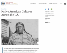
Native American Cultures Across the U.S.
Learners examine how American Indians are represented in today's society. They read stories, analyze maps, and complete a chart and create an illustration about a specific tribe.
Curated OER
People Behind the Parks
Explore U.S. geography with your class by viewing a documentary. Show a portion of the Ken Burns documentary "The National Parks," and identify the individuals responsible for keeping the parks in order. Elementary and middle schoolers...
Curated OER
Plotting Slave Population Density in Connecticut in the 1700's
Tenth graders explore slavery in the U.S. by researching the web. In this U.S. history lesson plan, 10th graders identify the geography of Connecticut and the overall involvement the state had in the slavery process. Students view data...
Curated OER
Egg Hunt Lesson
Fourth graders explore religious holidays by participating in an egg hunt. In this Easter instructional activity, 4th graders review the different U.S. states and capitols before completing a geography egg hunt activity. Students read...
Curated OER
Agriculture Cares for the World
Students explore world geography by analyzing agriculture. In this dietary habits lesson plan, students discuss the role parents play in their children's diet and where the food comes from. Students write agricultural research paragraphs...
Curated OER
U.S. States Border Canada: Crossword Puzzle
For this United States history worksheet, students use the 14 clues in order to fill in the crossword puzzle with the appropriate states that border Canada as answers.
Curated OER
U.S. geography for Children: New York
In this geography worksheet, 5th graders study the state of New York. Students follow the given directions to complete 5 tasks on the state map that is given.
Curated OER
Maps Can Help Us
First graders explore the geography of Montana by analyzing geographic maps of the area. In this Native American reservation lesson plan, 1st graders discuss the similarities and differences between reservations in the state of Montana....
Curated OER
Comparing the European Community with the U.S.
Students research a country to compare with the U.S. In this compare/contrast lesson, students research the CIA World Factbook research a European country's characteristics. Students calculate growth rate and doubling time and examine...
Curated OER
The Geography of Africa
Hop a flight to Africa in this presentation, which includes brilliant and appealing photographs of the continent as well as maps and graphs about its geography, topography, and climate. Those who are researching Africa for a project or...
Curated OER
Real World Investigation- Math and Geography- Elevation Changes
In this math and geography real world investigation, 6th graders plan a driving trip to a city that is located several states away from their home while recording the elevations of three cities that are included in the trip. They use...
Curated OER
Mapping the Most Common U.S. City Names
Students discuss the most common U.S. place names. They map the locations of U.S. cities with the most common names and use an atlas, or an online map tool such as MapQuest or Yahoo Maps.
Curated OER
There Is No Place Like Home! U. S. Immigration in the 1800's.
Learners explore immigration in the late 1800's. They identify and describe the settlement patterns of European immigrants to the U.S. Students work in groups to research immigration from specified countries.
Curated OER
Water Features - Lesson 2 - U.S. Political Map Grade 4-5
Students locate water features on maps. In this geography lesson plan, students complete worksheets that require them to identify water features on a U. S. political map.
Curated OER
Biggest Cities in Each State Quiz
In this online interactive geography quiz worksheet, students examine the chart that includes the names of 50 U.S. states. Students identify the names of the two largest cities in each state in 8...
Curated OER
Louisiana Purchase
Students explore U.S. territorial expansion. In this Louisiana Purchase lesson plan, students investigate how the purchase was funded and determine how diplomatic actions were part of the land transfer. Students analyze several primary...
Curated OER
Exile: Cuba and the United States
High schoolers gain an understanding of U.S./Cuban Relations. In this world history lesson plan, students examine the events of the Cuban revolution and their effect on U.S.-Cuban relations and U.S. foreign policy.
Curated OER
Lesson 1: Map Data and the Census
Young scholars learn about the history of the census. In this U. S. Census lesson plan, students develop an understanding about how the United States Constitution grants and distributes power and discover how the spatial organization of...
Curated OER
Geography A to Z : Letter H
What starts with the letter H? A lot of things do! Including the names of seven different geographic locations around the globe. Learners use the clues to determine the answers, all beginning with the letter H.
Other popular searches
- U.s. Geography Lesson Plans
- U.s. Geography Southeast
- U.s. Geography Slavery
- U.s. Geography Northeast
- U.s. Geography California
- U.s. Geography Oregon
- U.s. Geography and Economics
- U.s. Geography Pdf
- U.s. Geography West
- U.s. Geography Activity
- U.s. Geography + Slavery
- U.s. Geography Southwest


