Indian Land Tenure Foundation
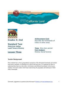
More Tribal Homelands
Here is a very fun idea that introduces young learners to how geographical location affects cultural development. They are introduced to four areas where Native Americans have lived in the past by reading stories and examining images....
Cornell University
Too Much of a Good Thing?
Continuing their study of beneficial insects, young entomologists discover where in the world some of these bugs are. By labeling, coloring, and using the scale on a map, pupils explore the territories and arrival of the Asian lady...
Colorado State University
Why Does the Wind Blow?
Without wind, the weather man wouldn't have much to talk about! Blow away your junior meteorologists with a creative demonstration of how wind works. The activity uses an empty soda bottle and compressible Styrofoam peanuts to illustrate...
NOAA
Why is Hawaii's Ocean Important?
Studying the oceans? Focus on Hawaii's ocean with a resource packed with activity-based worksheets. Everything from products that come from the ocean to the abundance of plants and animals that call the ocean their home, Hawaii's ocean...
CK-12 Foundation
Location and Direction: Angle from the Equator
From any angle, this interactive is helpful. Earth science super stars explore a location's angle from the equator through a hands-on activity. Questions guide learners as they test their knowledge of direction and geometry used in...
National Park Service
Weather Patterns of the Pacific Ocean
How do oceans affect weather patterns? Learners define vocabulary associated with dew point, topographical lifting, condensation, and formation of clouds and precipitation as they explore the weather in the Pacific Northwest. They also...
Curated OER
United States Map Quiz
In this online interactive geography quiz learning exercise, students respond to 50 identification questions about the shapes of countries shown. Students have 5 minutes to complete the quiz.
Curated OER
Canada Or Bust
Seventh graders answer the following problem based lesson with the essential question, "Which city or town in Canada would adequately meet my family's needs for relocation?" They present their city and provide rationale for its...
Curated OER
Great Monuments of the World
Young scholars explore the wonders of the world through inquiry. In this world monuments lesson, students investigate famous landmarks around the world as they conduct and apply research. Young scholars create products that feature their...
Curated OER
Shall We Go Dutch?
Students examine the language and cultural differences that were encountered by the Indians and the Dutch leading to disaster for the first European settlement in Delaware.
Curated OER
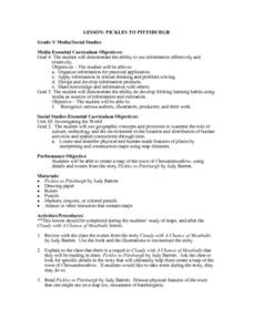
Pickles to Pittsburgh
Third graders explore the geography in the book "Pickles to Pittsburgh" by Judy Barrett. They read the story and identify the physical features of the town, discuss the elements included on a map, and create a map of the town of...
Curated OER
Vocabulary: Early New York
In this US history and vocabulary worksheet set, students complete 55 questions based on the vocabulary used when studying Early New York. They write sentences, unscramble words, write riddles, draw word meaning, and complete...
Curated OER
Explorer Comprehension Worksheet
In this exploration worksheet, students draw the routes of the listed explorers on the blank world map. Students should also provide a color-coded map key.
Curated OER
United States Map Lesson
Pupils explore basic map skills. In this United States geography lesson, students define "country" and "state," locate their state on a United States map, and identify and trace state boundaries defining their state and surrounding...
Curated OER
United States Map - Lesson 9
Students explore the concept of cardinal directions. In this geography activity, students identify the compass rose on a large U. S. map and then discuss the cardinal directions.
Curated OER
United States Map - Lesson 11
Students explore lakes of the United States. For this geography lesson, students identify noteworthy lakes on a map of the United States.
Curated OER
Three Mapping Activities
Students label three maps of China after being introduced to background information about the country. In this geography instructional activity, students color two maps and label various points of interest in China. Finally,...
Curated OER
Canadian Provinces Quiz
In this online interactive geography quiz activity, students examine the map that includes 13 Canadian provinces. Students identify the names of the provinces in 3 minutes.
Curated OER
Country Flags Quiz
For this online interactive country flag quiz worksheet, students examine the 20 pictured country flags and try to name all of the countries represented in 4 minutes.
Curated OER
South America Map Quiz
In this online interactive geography quiz worksheet, students examine the map that includes all of South America's countries. Students identify the 13 countries in 2 minutes.
Curated OER
Middle East Map Quiz
In this online interactive geography quiz worksheet, students examine the map that includes 26 Middle Eastern countries. Students identify the names of the countries in 4 minutes.
Curated OER
Central America Map Quiz
In this online interactive geography quiz worksheet, students examine the map that includes 22 Central American countries. Students identify the names of the countries in 3 minutes.
Curated OER
Canada Map Quiz
In this online interactive geography quiz activity, students examine the map that includes 13 Canadian provinces and territories. Students identify the names of the provinces and territories in 2...
Curated OER
Famous Streets Quiz
In this online interactive geography quiz worksheet, students examine the chart that includes the names of 18 famous streets in the world. Students have 4 minutes to identify the names of the cities where the streets...
Other popular searches
- Us Geography
- Canada Geography Land Use
- Us and Canada Geography
- Us Geography Climate
- Us Geography Skills
- Usa Geography Map Skills
- Us Geography Pdf
- Us Geography Scavenger Hunt
- Us Geography Northeast
- Us Geography Activity
- Us Geography Slavery
- Us Cultural Geography


