Curated OER
Africa: Geography Concept Map
In this geography skills instructional activity, students complete a graphic organizer where they list African countries and their geographic features, languages spoken, natural resources, and historical facts.
Freecloud Design
Stack the States™
Kids have fun learning US geography and state facts, including capitals, nicknames, major cities, and landmarks. They can choose between the game, or informational flashcards for each state.
Curated OER
Create Your Own Country Project
Young scholars demonstrate their knowledge of geography with this fun, collaborative social studies project. Working in small groups, students develop their very own countries, writing descriptions...
Curated OER
Little House in the Census: Almanzo and Laura Ingalls Wilder
How would you use census data from 1880-1900? Here are a set of ways you can incorporate the book Little House on the Prairie and US census data from that time period. Learners will research the validity or the book based on factual...
Fremont Unified School District
4th Grade California Relief Map Project
Bring life to your next California geography lesson with this great project! Learners design a three-dimensional wall relief map of California, painting and decorating regions using a variety of materials and labeling major geographical...
Curated OER
MAISA and the REMC Association of Michigan
Students complete online research to study geography's impact on weather. In this geography and weather lesson, students research weather in their city for ten days using an online website. Students bookmark the site, enter data into a...
Curated OER
Our Country's Geography
Third graders study geography. In this United States landforms lesson plan, 3rd graders create a map of the U.S. made out of dough. They use various edible treats to mark the country's capital, the plains, the mountains and the rivers...
Curated OER
Getting to the Core of World and State Geography
Students create topography relief maps. In this geography skills lesson, students review geography core knowledge skills, design and make a state relief map, and compile a student atlas.
Curated OER
The Geography of Europe
Students examine maps of Europe. In this geography skills lesson, students interpret several maps to determine the boundaries of the European Union and respond to assessment questions about the maps.
Curated OER
Geography Journey
For this geography worksheet, students use a map of Amtrak train routes (not included) to answer 10 short answer questions. Students describe physical features and landmark cities they would see if traveling by train across the country.
Curated OER
A Tough Nut to Crack
Sixth graders explore agriculture by examining world geography. In this pecan cultivation lesson, 6th graders identify the history of the famous nut and the impact it has on the U.S. economy, diet and human body. Students define...
Curated OER
The Desert Alphabet Book
Students explore world geography by researching a science book with their classmates. In this desert identification lesson, students utilize a U.S. map to locate the geographical locations of deserts. Students create an oral report based...
Curated OER
Landforms of Illinois
Fifth and sixth graders are introduced to the primary landforms of Illinois and discover how they were created. Landform cards are made for each pupil. They use the twenty-questions format until they have identified each one. Then,...
New York City Department of Education
Geography and Early Peoples of the Western Hemisphere
Young historians discover the early people of the western hemisphere. The unit explores how the land changed, how it was used and homes of early Americans such as Incas, Mayans, Inuits, Aztecs, and Pueblos. Individuals also examine these...
Curated OER
The Time Has Come: Poetry and Drama Use in the Geography Class
Students use drama and poetry in their Geography class. In groups, they role play an interviewer or the interviewee in various plays that were presented to them. In their role, they must locate and label where the countries mentioned...
Curated OER
US Policy In Somalia
Students investigate the US policy for the country of Somalia. They conduct research using a variety of resources. They locate the country and then discuss major geographical features of the areas. Students discuss the present US...
Curated OER
The United States and Canada: Climate and Vegetation
Display U.S. and Canadian climate and vegetation through this text-companion learning exercise. Learners read about the geography of these regions, take notes, and answer 3 comprehension questions as they read the selection. A graphic...
Curated OER
Early America: Jeopardy Game
Fifth graders can put their knowledge of early American life, the 13 colonies, and maps to the test when they play this Jeopardy game. The game covers terminology, famous people, and geography related to Colonial American times. Note:...
Curated OER
The 50 States and its Holidays
Though the format of this ELL lesson plan is confusing (the standards listed are for plate tectonics, yet the objectives are for American geography and holidays), a teacher could glean some ideas from the main idea. Here, pupils complete...
Curated OER
California's Golden History: 1848-1880
Using a variety of online resources, learners study life and society in California during the gold rush. They use a map to identify area where gold was located, explore pre-selected websites, describe mining practices, and create an...
Richmond Community Schools
Map Skills
Young geographers will need to use a variety of map skills to complete the tasks required on this worksheet. Examples of activities include using references to label a map of Mexico, identify Canadian territories and European...
Happy Housewife
State Notebooking Pages
When learning about US geography, it can hard to remember facts about 50 different states. Help your young scholars organize all of this information with a collection of easy-to-use note-taking guides.
Concord Consortium
Center of Population
Let the resource take center stage in a lesson on population density. Scholars use provided historical data on the center of the US population to see how it shifted over time. They plot the data on a spreadsheet to look the speed of its...
Curated OER
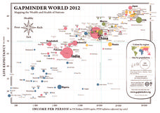
Gapminder World 2012
Here is a very interesting infographic that compares the average life expectancies, per capita incomes, and population sizes of every country in the world in 2012.
Other popular searches
- Us Geography
- Canada Geography Land Use
- Us and Canada Geography
- Us Geography Climate
- Us Geography Skills
- Usa Geography Map Skills
- Us Geography Pdf
- Us Geography Scavenger Hunt
- Us Geography Northeast
- Us Geography Activity
- Us Geography Slavery
- Us Cultural Geography


