Curated OER
Introducing The Gulf Stream
Sixth graders research the average temperatures of different places on Earth. In this earth science lesson, 6th graders explain how the sun's heat cause ocean movement. They discuss how temperature change affects the weather we experience.
Curated OER
Eyewitnesses to Change
Students explore recent changes in the Artic's climate that have been observed by Artic residents. They watch videos, take notes and create a concept map. They also look at historical weather data from a specific Artic community. The...
Curated OER
Rain Shadows and Sea Breezes
Students plot the average rainfall for a variety of cities in the United States. Using the map, they work together to determine patterns on which toxicants are transported through the air. They determine the impacts of various weather...
Curated OER
Geological Forces and Topography
Students discuss and research the Earth's geological processes. In this geology lesson plan, students study maps of Utah and the United States to learn about geological features. Students then complete the research cards for each area of...
Curated OER
Climate Systems - Which Location Is Best For Me?
Students study the difference between weather and climate. In this climate systems lesson students search the Internet for the parts of the Earth's system, gather climate data and complete a challenge scenario.
Curated OER
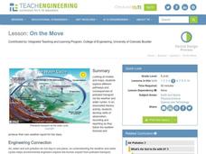
On the Move
Students explore different pathways and consequences of pollutant transport via the weather and water cycles. They observe and record weather information and produce their own weather report for the class.
Curated OER
Everyone Knows It's Windy
Students create an anemometer, an instrument that measures wind speed.
Curated OER
Hot, Wet, and Cold
Pupils research climate data for a city in each of the 5 major geographic sections of Texas. They use data to describe the climate and what influence the geography of that section has on the weather.
Curated OER
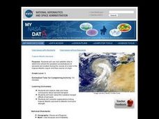
Troical Atlantic Aerosols
Students explore the effect aerosols have upon he weather and climate. They observe NASA satellite images to explore and draw conclusions about aerosol transport. From studying the images, students track the path of aerosols. They...
Curated OER
Climate Patterns across the United States
High schoolers articulate differences between climate and weather using examples in a written statement. Using climate data from across the country, they describe climate patterns for various parts of the United States on a map. Students...
Curated OER
Cold Fronts
Students determine its' direction of movement, and list at least five weather conditions associated with the specific front, given animations of several atmospheric variables during a cold front passage. They list at least three weather...
Curated OER
The Grand Canyon
Fourth graders study the Grand Canyon. They research the Grand Canyon and locate the Colorado River on the map of Arizona. They discuss erosion and read how sedimentary rock was formed. They view photographs of the Grand Canyon and...
Curated OER
The Mormon Trail Through Iowa
Students read selections from travel diaries and create their own travel diary. For this Mormon Trail through Iowa lesson, students discover background of the Mormon Trek of 1846 and discuss how a group may be persecuted for beliefs. ...
Curated OER
The Geography of Tornadoes OR
Students learn some basic facts about tornadoes and map two selected tornado statistics by state, and observe, analyze and speculate about the pattern(s) created by the completed map.
Curated OER
Field Trip Preparation
Students make a contingency plan in case of unexpected events such as bad weather. They discuss safety and appropriate conduct.They map out a schedule to ensure that sufficient time is allotted for all activities.
Curated OER
Animal Trackers
Students use space technology to monitor migratory species, map their movements, and gather data about their habitats and possible responses to climatic shifts.
Curated OER
Balancing the Scales: Understanding Ratios
Students are introduced to the concept of ratios. In groups, they convert sets of numbers into a ratio. After practicing, they use the ratios and proportions to solve story problems. They also calculate map distances and discover map...
Curated OER
PLATE MOVEMENTS AND CLIMATE CHANGE
Pupils label three geological maps with continents provided to analyze the relationships between the movement of tectonic plates and the changes in the climate. In small groups, they discuss their findings and form hypotheses about the...
Curated OER
Social Studies: Underground Railroad
Pupils role-play as escaped slaves making their way from North Carolina to Canada, stopping in Indiana. They track their journeys on maps and include a stop at Harriet Tubman's. Students write three paragraphs about how Tubman aids them...
Curated OER
Atlantic Canada Report
Ninth graders create a report that will show an in-depth knowledge of the various geographical and climatic features of Atlantic Canada. They produce various items, on paper and using the computer, to demonstrate knowledge of outcomes,...
Curated OER
Discovering the Physical Geography of Washington
Pupils develop a mental map of the state of Washington and draw it on paper. Using the Virtual Atlas, they identify the physical features of the state and draw them on their map. They also examine the populations and diversity of the...
Curated OER
The Bulbs: Camas and Daffodil
Fourth graders become aware of the importance of the camas bulb to the Nez Perce people, they learn the parts of plants, and gain understanding of the interdependence of Nature. They study about the possible causes and outcomes of global...
Curated OER
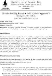
Give Me Back My School: A Back to Basics Approach to Ecological Restoration
Ninth graders research local geography to create successful, ecological school landscaping. They determine soil type, average weather patterns and temperature graphs and use the information to select ideal plants and plant maintenance...
Curated OER
Valley Forge
Students describe how location, weather, and physical environment affect the way people live, including the effects on their food, clothing, shelter, transportation, and recreation. They also describe the lives of American heroes who...
Other popular searches
- Reading Weather Maps
- Interpreting Weather Maps
- Interpret Weather Maps
- Surface Weather Maps
- Creating Weather Maps
- Weather Maps With Fronts
- Pressure and Weather Maps
- Analyzing Weather Maps
- Construct Weather Maps
- Winds and Weather Maps
- Interactive Weather Maps
- Just Interpret Weather Maps


