Curated OER
Thematic Unit on Cats
Students discover in which climates the cats of the world live in. They review the different climates of the world and use maps and globes to help them locate continents.
Curated OER
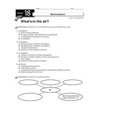
What's in the Air?
In this air worksheet, students will choose the correct definition for atmosphere, troposphere, stratosphere, and pollutant. Then students will complete a concept map showing what components make up air. This worksheet has 4 multiple...
Curated OER
Isotherms and Fronts
In this weather instructional activity, students draw in isotherms on a temperature map. Students indicate the location of cold fronts, warm fronts, and stationary fronts. This instructional activity has 2 drawing questions.
Curated OER
Apple: Seed to Tree
Students grow seeds of an apple and learn about Johnny Appleseed. For this apples lesson plan, students map Johnny Appleseed's travels, learn how he got his name, compare different Johnny Appleseed books, and grow apple seeds themselves.
Project SMART
Rocks and Minerals: Touch the Earth
Students complete a unit of lessons on rocks and minerals. They conduct research, write e-mail questions to geologists, write daily journal entries, label maps demonstrating types of rocks/minerals found, and create a web page that...
Curated OER
At Home On The Range
Students explore the history and domestication of the Bovidae family and their importance to our prairie ecosystem. Using a map of the United States, students located the American Great Plains. They complete worksheets and discuss...
Curated OER
Arctic Microclimates
Students identify, measure, and average micro-climatic temperatures in a particular region. They draw a small-scale map of an area to be sampled (classroom, playground, park, backyard) and identify potential locations for...
Curated OER
At Home on the Range
Fifth graders complete a worksheet. In this bison and great plains instructional activity, 5th graders read information about bison and complete a worksheet of comprehension questions. Students locate the American Great Plains on a map...
Curated OER
Crossword Review
Learners practice using their target language vocabulary by completing a crossword puzzle. In this foreign language lesson, students complete several random tasks based on new vocabulary words in their target language dealing with...
Curated OER
Lesson Plan of a Thematic Project - Water
Sixth graders investigate the properties of water. In this life science lesson, 6th graders create a concept map of water. They share their work with the class.
Curated OER
CURRENT AND CLIMATE
Students study currents and how they have been used to plot courses for travel. They examine the ocean currents in both the Atlantic and Pacific and discuss their effect on local weather.
Curated OER
Climate in Our Back Yard
Students construct a "A Year in Pennsylvania" poster on which they creatively describe at least three examples of how the climate they live in shapes their lives during every season of the year.
Curated OER
An Introduction to Jan Brett
Students explore the concept of Jan Brett. In this author study lesson, students are introduced to several Jan Brett books with visuals, listening centers, and video. Students browse the internet in search of information...
Curated OER
Surface Air Temperature Trends of the Caribbean
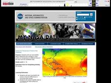
Pupils investigate the seasonal changes to sea surface and near-surface air temperatures near the equator. They use actual satellite data to track and graph the differences in air and sea temperatures during different seasons in the...
Curated OER
Coronado: Misfortune's Explorer
Fourth graders discuss the importance of Coronado's expedition through Texas and the trials his men endured during the journey. They view and discuss a map of Coronado's route, the effects of weather on the Great Plains, and Buffalo....
Curated OER
Hurricanes
Eighth graders gather information on hurricanes that are affecting the world at the time of the lesson. They work together in groups to collect the data and record their information in a table. They are asked questions to finish the lesson.
Curated OER
Sky Watching
Young scholars trace how weather patterns generally move from west to east in the United States.
Curated OER
Clouds
Students explore the characteristics of clouds, their formation, symbols used in their identification, and the relationship of clouds to weather. The activity focuses on how they are formed and their classification.
Curated OER
How Can We Locate Specific Places On Earth?
Second graders discover how to use longitude and latitude to locate specific sites on Earth. They compare old and new ways of locating specific places, and discover how latitude and longitude coordinates are used to locate places on Earth.
Curated OER
Celebrating the Solstice and Equinox
Fourth graders graph the number of daylight hors throughout the year and examine why day length varies. They discover that seasonal changes and latitude on Earth affect the number of hours of daylight in each day. Students listen to...
Curated OER
Shadow Trackers
Young scholars use online websites to inquire about the cycle of day and night. For this web based lesson, students are able to see the movement of the sun and Earth. Young scholars can look at different parts of the Earth as if they...
Curated OER
Modern Japan: Tsunami Relief
Students participate in a activity that is concerned with modern day tsunami relief in Japan. They conduct research and chart the regional alert centers. Students also note the worldwide effort to help those in need.
Curated OER
Under The Sea
Second graders study how a tsunami is formed by underwater events such as earthquakes, volcanoes or landslides. They discuss what they knew about living and non-living things in the ocean.
Curated OER
Globe Lesson 9 - Around the World - Grade 6+
In this geography skills worksheet, learners read 5-travel scenarios and use their problem solving skills to respond to 9 short answer questions.
Other popular searches
- Reading Weather Maps
- Interpreting Weather Maps
- Interpret Weather Maps
- Surface Weather Maps
- Creating Weather Maps
- Weather Maps With Fronts
- Pressure and Weather Maps
- Analyzing Weather Maps
- Construct Weather Maps
- Winds and Weather Maps
- Interactive Weather Maps
- Just Interpret Weather Maps


