Curated OER
Planning a Tourist Resort
Students work in teams of 2 to complete the presentation portion of the assignment. They may be required to work alone or may work with their partner to complete the "Board Member's Responses."
Curated OER
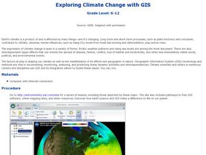
Exploring Climate Change with GIS
Students investigate climatological changes that are occurring to the Earth. In this climate change lesson, students access an assigned web site to view maps and lessons that show how climate change makes a difference to life on Earth.
Curated OER
Chinese Classroom Internet Activity
Students use the internet to complete an online activity in Chinese. Using the weather section, they research the weather conditions in Hong Kong and other popular cities in China. They answer Chinese questions in Chinese about the...
Curated OER
The Accuracy of Climate Data
Young scholars use maps to determine how accurate climate data really is. They also answer questions using a table of data.
Curated OER
Olympic Games Snowboard Design
Students find travel destinations and information on countries around the world, and use their knowledge to create a snowboard design that represent the country they pick. They explore maps, weather, geography, languages, in their quest.
Curated OER
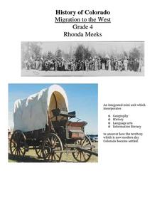
History of Colorado-Migration to the West
Fourth graders identify reasons for people moving to the Colorado Territory and examine how moving in the 1800's is different than moving today. They also practice reading maps and gathering information from maps, as well as, describe...
Curated OER
Earth's Surfaces
Students identify and define geology and earth surface vocaulary and their meanings to classify rocks and explore caves and their properties. Students find rocks and test them according to Moh's scale. They create a color coded earth...
Curated OER
Rain Drops Keep Falin' On My Drainage Basin
Students compile information about rainfall, lake elevations and releases of water from Tuttle Creek reservoir into maps, graphs and charts.
Curated OER
Trekking to Timbuktu: The Geography of Mali - Student Version
Eleventh graders locate Mali on a world map, describe the landscape and climate of Mali, and locate the city of Timbuktu and describe the local weather. They compare life along the Niger in ancient times to that of today
Curated OER
Stratigraphy -- Layers of Time in the Earth
Students are introduced to the process of stratification. Using the internet, they read about the Richard Beene archeological site near San Antonio. Using a map, they color code the different layers present at this site and answer...
Curated OER
Treasure Hunt Region
Students are introduced to new geography related vocabulary words. In groups, they focus on a different region of the school and develop a new name for it. They create a treasure map for another group to use in the region of the school...
Curated OER
Our State Road Trip
Students take a virtual tour of the country of China instead of a state. Using the Internet, they examine the differences between a political and physical map and use latitude and longitude to locate specific places. They also research...
Curated OER
Texas Week
Students explore Texas in the past and present. They pick out cities on a map and find information and analyze an Internet site.
Curated OER
Adapted to Fire
Fourth graders explore forest species' adaptations to fire by participating in a scavenger hunt and mapping a burned forest. Students create maps and explore how indigenous species adapted to living with fire.
Curated OER
Landforms All Around
Students create a "Landform Dictionary". They develop an overlay map and participate in hands-on activities to identify the key characteristics of landforms. They discuss the plant and animal life of these areas. Handouts for the lessons...
Curated OER
Why Here? Why Not There?
Middle schoolers analyze a map and graph information on eleven countries. Using the characteristics of the countries, they determine if they should host the summer or winter Olympic games. After viewing a video, they locate the...
Curated OER
The Rainforest
Fourth graders create a brochure containing accurate information about plants, animals, weather, location, and transportation in the rainforest.
Curated OER
Living With Fire
Students identify effects of treatment weather on behavior of a wildland fire. They view simulation game that predicts effects of forest management on fire behavior.
Curated OER
Classroom Triangles
Students use bearing measurements to triangulate and determine objects' locations. Working in teams of two or three, students must put on their investigative hats as they take bearing measurements to specified landmarks in their...
Curated OER
"Across Oregon On The 45th N Parallel" A Transect of Oregon
Students explore the physical geography of Oregon. In groups, students collect weather and elevation information on Oregon. They organize the data and create maps and graphs of the information. Afterward, students compare the...
Curated OER
Paws in Jobland
Pupils explore jobs in different countries . In this lesson about different countries through research. Students are broken into groups and given a country to research. Each group is provided with a worksheet with 14 questions to be...
Curated OER
Regions of the US: Gulf Stream, States and Their Capitals
Fifth graders identify one way of dividing the US into geographical regions and then consider alternate ways of doing the same. They locate each of the fifty states and their capitals on a map. They research the Gulf Stream region.
Curated OER
Attu Battlefield: U.S. Army and Navy Airfields on Attu
Young scholars use maps, readings, drawings and photos to research the World War II Battle of Attu. They explain the importance of the battle, discuss the valor and loyalty of both American and Japanese troops and analyze sources of...
Curated OER
Arsenic Globally
High schoolers, using directed questions, identify five internet resources. They use these resources to identify relevant information by highlighting those sections that address the provided questions. Students present the answers to...
Other popular searches
- Reading Weather Maps
- Interpreting Weather Maps
- Interpret Weather Maps
- Surface Weather Maps
- Creating Weather Maps
- Weather Maps With Fronts
- Pressure and Weather Maps
- Analyzing Weather Maps
- Construct Weather Maps
- Winds and Weather Maps
- Interactive Weather Maps
- Just Interpret Weather Maps


