Curated OER
The Window
Students read a story entitled, "The Window," and discover how some cultures are rejected by others. Students write a letter expressing feelings of rejection and keep a journal of significant events in the story. Using a graphic...
Curated OER
Attu: North American Battleground of World War II
Students examine military maps and photos to better explain why an isolated battle on a remote island in Alaska alarmed the nation. They explain how the Japanese occupation and American recapture of Attu were significant in the history...
Curated OER
Korea Cultural Lesson Plan
Students engage in a study of geography and maps of Korea. They examine charts and graphs. Students are expected to interpret the information accurately and completely. The geography skills can be used on other countries as well.
Curated OER
A Season for Chapters
Art, music, poetry, and the beauty of the seasons is what you'll find in this very nice unit idea. You can use any of the suggested books and activities to engage your second graders in an exploration of the changes that take place...
Curated OER
Air Masses
Students examine the physical characteristics of several types of air masses to discover how air masses can be identified and defined by their temperature and moisture content.
Curated OER
"Our Environment"
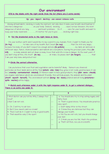
In this environment worksheet, students access a website to answer questions about the landscape and biogeoclimate of British Columbia. This worksheet has 6 short answer questions.
Curated OER
Mira: Activity 12
Students review clothing and climate words in Spanish. They choose a Spanish-speaking country, and on a piece of paper folded in half or in quarters, they draw the seasons of their country with people dressed accordingly for each...
Curated OER
Nevada Trilogy
Students simulate and plan a trip from St. Louis to the Sacramento Valley as early emigrant parties would have. They list necessary provisions for the amount of time they would spend traveling.
National First Ladies' Library
Ah! Those Horse and Buggy Days!
Students discuss contemporary methods of travel and the time it takes to travel to places. They use the Internet to explore 18th century travel. Students work in small group to research the amount of time it would have taken...
Curated OER
Stargazers and Skywatchers
Learners observe the daily motions of the sun and relate them to the functions of a sundial. They determine the locations of sunrises and sunsets and determine how the elevation of the sun effects temperature.
Curated OER
Naya Nuki's Journey
Students read "Naya Nuki Shoshoni Girl Who Ran" by Kenneth Thomasma. Students chart Naya Nuki's route on a map and identify the navigational signs she used to find her way home. Students also analyze the weather she encounters.
Curated OER
Science: Hurricanes As Heat Engines
Students conduct Internet research to track the path of Hurricane Rita. They record the sea surface temperature of the Gulf of Mexico during and after the hurricane and draw conclusions about how hurricanes extract heat energy from the...
Curated OER
Coral Bleaching in the Caribbean
Students use authentic satellite data on the NASA website to determine when the sea surface temperature meets the criteria to induce coral bleaching.
Curated OER
"Tsunamis"
Students visit a PBS Website about tsunamis to consider their causes, effects and steps countries have taken to try to defend against them. They answer questions and create a brochure explaining tsunami facts and procedures to survive a...
Curated OER
Calm After the Storm
Students create posters providing information about Sri Lanka's history and society both before and after the tsunami. They write response papers considering the future of this small country devastated by the natural disaster.
K12 Reader
Meteorologists
Meteorologists and the tools they use are the subject of a reading comprehension worksheet that asks kids to read the attached article and respond to a series of comprehension questions.
Curated OER
Central Park Field Trip
Students visit the park to observe signs of spring in the forest and pond environments. In this field trip activity, students explore the park for various items
Curated OER
The Progressive Era in Illinois
High schoolers collect photographs on the Progressive Era in Illinois, then write three newspaper articles, using one photo per article. The article will highlight an event in Illinois during the Progressive Era. The newspaper must also...
Curated OER
The Cloud in the Bottle
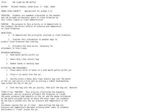
Pupils observe a demonstration of how pressure and temperature affects cloud formation.
Curated OER
Gallery Walk Questions on Earth's Radiation Balance
Questions that can be used in a lesson plan on Earth's radiation balance are suggested in this resource. It is not a lesson plan, per se, but it is a list of questions for stations within a "Gallery Walk" lesson plan. The link to how...
Curated OER
English Vocabulary Skills: AWL Sublist 1 - Exercise 3b
In this online interactive English vocabulary skills worksheet, students answer 10 matching questions which require them to fill in the blanks in 10 sentences. Students may submit their answers to be scored.
Curated OER
Learning Lesson: How To Make A Rain Gauge
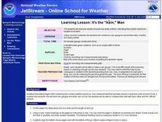
Students discover that rainfall amounts are rarely uniform which means the amount of rain is different from location to location. They construct their own rain gauge using everyday materials.
Curated OER
A Funny Taste
Learners participate in a demonstration that illustrates the relative amounts of salt in various bodies of water including the Dead Sea, Sallt Lake, Ocean water and distilled water. They taste and compare various mixtures.
Curated OER
It's Rainin', It's Pouring
Students take a quick examine part of the water cycle, and the combined gas laws. The activity lead them through the conditions necessary for cloud formation and allow them to create clouds in three different hands-on activities.
Other popular searches
- Reading Weather Maps
- Interpreting Weather Maps
- Interpret Weather Maps
- Surface Weather Maps
- Creating Weather Maps
- Weather Maps With Fronts
- Pressure and Weather Maps
- Analyzing Weather Maps
- Construct Weather Maps
- Winds and Weather Maps
- Interactive Weather Maps
- Just Interpret Weather Maps


