Curated OER
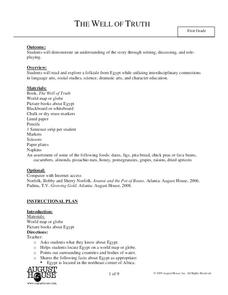
The Well of Truth
Students read and explore an Egyptian folktale. For this folktale lesson, students read the book The Well of Truth and discuss geographical facts about Egypt. Students complete several reading comprehension activities including a...
Curated OER
Lesson 4- Arthur Meets the President
Students create a pamphlet. In this story evaluation lesson, students complete a story evaluation on Washington, D.C., create a pamphlet on Washington, D.C., and then discuss the most interesting thing they learned.
Curated OER
Bluebirds Project
In this bluebirds project worksheet, students are given directions on completing a project about bluebirds including measurements, scientific method questions, data entry, and more. Students complete 15 exercises.
Curated OER
The Log Book of a Connecticut Slave Trade Ship
Seventh graders investigate the slave trade. In this Middle Passage lesson, 7th graders read excerpts of ship logs from Connecticut Slave Trade ships. Students respond to the provided analysis questions based on the logs.
Curated OER
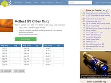
Hottest US Cities Quiz
In this online interactive geography quiz learning exercise, students respond to 20 identification questions about the hottest cities in the United States. Students have 4 minutes to finish the timed quiz.
Curated OER
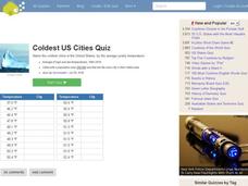
Coldest US Cities Quiz
In this online interactive geography quiz worksheet, students respond to 20 identification questions about the coldest cities in the United States. Students have 4 minutes to complete the quiz.
Curated OER
Exploring Rocks
Students recognize differences in the size, shape, texture, and color of different rocks. In this rocks lesson plan, students also learn and repeat back how a volcano erupts and make one out of a toilet paper tube.
Curated OER
Building a Scale Model
Third graders create a model of the solar system. In this solar system lesson, 3rd graders create a scale model of the solar system. Working in pairs students solve mathematical problems to correctly measure the distance each planet is...
Curated OER
Science Trail
Students explore the solar system by conducting Earth science experiments. In this Sun lesson, students identify the different seasons on Earth and discuss their purpose and cause. Students create a sundial and observe the changes to...
Curated OER
Japan and Art
Students discuss the art of Japan as it relates to Japanese culture and geography and then create individual postcards reflecting the information learned from the lesson. This lesson includes possible enrichments.
Curated OER
Making Sense of Unusual Findings
Students work on the development of observation skills and seeing how they can be used in different contexts. The lesson is good for helping the beginner and novice, along with encouraging and reminding the expert observer of right...
Curated OER
The Sound of Calm
Students examine the relationships that exist between ocean currents, wind and climate. Using those relationships, they discuss how they affect the oceans. They create their own music to represent the sounds of the ocean and share them...
Curated OER
World Map and Globe
Young scholars locate and identify continents and countries. In this world map lesson, students locate and identify one country on each continent.
Curated OER
Using Soil properties and Vegetation Differences to Hypothesize the Land Use History and Topographic Differences between Two Locations
Ninth graders take soil samples and perform tests on these samples.
Curated OER
Earthweek
Students explore the ongoing changes in the relationship between human beings and their physical world. They read articles on environmental changes. Students write a short analysis of the effect of the event on the residents of the area...
Curated OER
Bell Live! The Great Lakes: A Superior Adventure
Students participate in a virtual field trip to Lake Superior. In groups, they perform experiments in which test the level of toxins and bacteria in the water. They also watch video segments life in the lake and discuss their observations.
Curated OER
Rainy Day Hike
Students develop awareness about the water cycles. They identify the watershed in which their school is located. They explain the role the schoolyard plays in the watershed.
Curated OER
The Pony Express
Fourth graders reasearch the history of the Pony Express on the internet or they can use books from the school or public library. They write a one-page story which incorporates their research. They share their stories with the class by...
Curated OER
Introduction to the Barnegat Bay Estuary
Students research estuaries. In this estuaries lesson, students discuss the differences in a bay and an ocean. Students watch a PowerPoint of the properties of the estuaries and geography of Barnegat Bay. Students complete a worksheet...
Curated OER
Physical Habitat of a Stream
Young scholars measure in metric units and use a stopwatch, calculator. They collect data with minimal instructions after the initial pre-activity briefing, then record data in the data sheets provided.
Curated OER
Natural Hazards
High schoolers evaluate the hazards of naturally occurring events. After watching a video concerning safety hazards, students work in groups to discuss the safety issues involved in taking a trip to a mountainous region. ...
Curated OER
Farming Idaho
Students use a digital atlas to explore areas in the Western United States that depend heavily upon water. They explore the type of soil and the farming that is compatible with the soil. As a class, students explore Idaho's economic...
Curated OER
Warm up to the Gulf Stream
Pupils find out the temperature difference between the Gulf Stream and the surrounding water. They locate the Gulf Stream on the infrared image of the eastern seaboard of the US.
Curated OER
Polar Food Web Comparison
Seventh graders practice the evaluation component of the scientific method while comparing and contrasting the similarities and differences of the food chains and webs of polar animal life. They study about classification and ecology...
Other popular searches
- Reading Weather Maps
- Interpreting Weather Maps
- Interpret Weather Maps
- Surface Weather Maps
- Creating Weather Maps
- Weather Maps With Fronts
- Pressure and Weather Maps
- Analyzing Weather Maps
- Construct Weather Maps
- Winds and Weather Maps
- Interactive Weather Maps
- Just Interpret Weather Maps


